Lake Louise

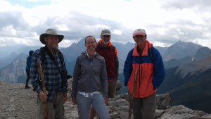
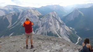
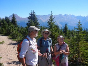
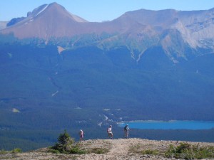
2-4 August:  The very popular tourist destination of Lake Louise is in the northern part of Banff National Park.  We camped for four nights in the trailer campground (hard-sided campers only; the separate tent campground had a tall electric fence around it to keep out bears) and hiked for three days.  Our first hiking destination was unavailable because when we arrived at the Moraine Lake trailhead, the parking lot and all available shoulder parking near it were completely full.  We chose an alternate hike, though, that proved to be very pleasant and not nearly so crowded.  We ascended by a wooded trail past a small lake to a semi-open area in Paradise Valley with good views of high peaks and mountain glaciers towering above, including Temple Mountain, which we could see from our campsite.
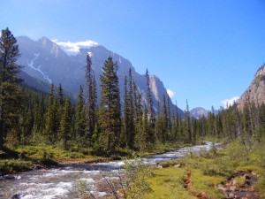
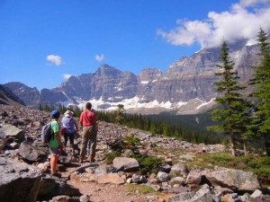
Paradise Valley
Paradise Valley
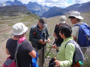
Amy, Sonia, and Judith stopping for a view
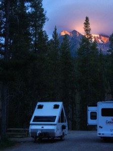
Temple Mountain at sunset from our campsite in Lake Louise

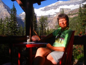
The next day we set our alarms and secured parking at the Lake Louise trailhead around 6:30.  The lake itself is higher than and a few kilometers away from the town of the same name.  It is the site of one of the grand hotels built by the Canadian Pacific Railway, Chateau Lake Louise, which has a commanding view of mountains and glaciers across the lake.  We hiked along the lake past the far end where the trail climbed gently to the Plain of Six Glaciers tea house, where we stopped mid-morning for tea, coffee, and biscuits.  We continued farther up the valley to an overlook of the glacier.  On the way back to Lake Louise, I took the Highline trail to see Lake Agnes while the rest of our group took the more direct (and downhill) route back.  Lake Louise and other lakes in this region are not only the beautiful turquoise color that we had seen in other lakes fed by meltwater from glaciers, but the water in them looks opaque rather than translucent because of the high concentration of glacial flour suspended in it.
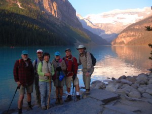
early start at Lake Louise
coffee break at the Plain of Six Glaciers Tea House
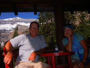
Dick and Sonia
Dick and Sonia
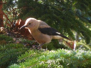
Clarks nutcracker
Clarks nutcracker

Our final day hike in the Lake Louise area was into the Valley of the Ten Peaks.  The trail starts at the outlet end of Moraine Lake, where the glacier had deposited a huge hill of boulders, blocking the stream valley.  We hiked in as far as Eiffel Lake, then on the way back hiked part way up another trail in Larch Valley, where the light green and feathery needles of many larch trees contrast to the darker green of fir, spruce, and pine.  This valley must be beautiful in the autumn when the larch needles turn yellow.  Larches are unique among coniferous trees in dropping all their needles every fall.  For most of our hike we were surrounded by tall, steep, rugged mountain peaks topped with snowfields and glaciers.
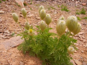
we called these mop-heads until we learned they are western anemones
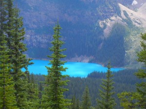
Moraine Lake--yes, that's the real color
Moraine Lake–yes, that’s the real color

The Columbia Icefield

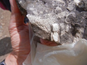
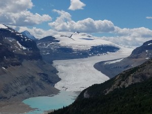
5-8 August:  From Lake Louise we drove north on the beautiful Icefield Parkway into Jasper National Park.  Our “Old Fogeys Outing Club” group was able to find three unoccupied campsites next to each other in Wilcox campground near the Icefield visitor center.  This campground is unserviced (no electric hookups) and first come, first served (no reservations available), but is conveniently located and has very attractive wooded sites.  We hiked up the nearby Parker Ridge trail, which is a real gem.  As we neared the top of the ridge, above treeline, Amy noticed small round whitish spots in the dark gray rocks and realized that they were fossils.  Soon our whole group was intently picking up the rocks at our feet and finding them chock full of fossils of a wide variety of invertebrates (corals, bryozoans, worm tubes, bivalves, etc.).  When we finally resumed our hike to the top of the ridge, we were rewarded with a panoramic view of mountains and glaciers, but the best view was yet to come.  Heading back downhill past the fossil beds, we took a spur trail that led to a superb view of the Saskatchewan Glacier, which is not visible from the road.  From this vantage point, we could see far up the valley occupied by this long glacier.  Longitudinal rows of rock debris on the top of the glacier give a real sense of the movement of the ice down the valley.  There was a small blue lake just below the toe of the glacier.  The stream flowing from it is the source of the North Branch of the Saskatchewan River, which flows eventually into Hudson Bay and into the Atlantic.
fossils hunting fossils
rocks full of fossils
view of Saskatchewan Glacier from Parker Ridge

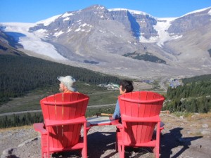
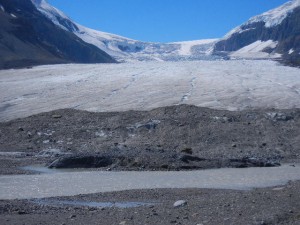
The next morning, before heading up to the northern part of Jasper National Park, we took a couple of hikes and went to the Icefields Visitor Centre.  The mountains on the west side of this valley hold the huge Columbian icefield, the source of glaciers whose meltwater flows into three of the world’s oceans, the Pacific, Atlantic, and Arctic.  A trail right from our campground led up onto a ridge on the east side of the valley overlooking the Athabasca Glacier directly across from the Icefield Centre.  When we got to the overlook, we discovered two bright red Adirondack-style chairs placed there by Parks Canada.  The tradition of placing Red Chairs in a few special places in a Canadian national park started in Gros Morne National Park in Newfoundland.  We discovered a couple of them on our Newfoundland vacation in 2014 with Rob and Judith.  At the Icefield Visitor Centre we viewed the park’s video and exhibits, then took the short walk across the road to a close view of the toe of the Athabasca Glacier.  Signs along the path mark the toe’s position in various years since the early 1900s, when it reached the bottom of the valley, to today, where it has receded perhaps a mile during global warming.  Walking on top of the glacier is restricted to guided tours because of the danger of falling into a crevasse.  Just a few years ago a young boy strayed beyond the restraining ropes, fell into a crevasse, and died of hypothermia before rescuers could reach him.

Wilcox Pass Trail view of Athabasca Glacier
the toe of Athabasca Glacier

Jasper

7-8 August:  Camped for three nights close to the town of Jasper at the northern part of Jasper National Park, we went for a couple of hikes up onto mountain ridges with extensive views.  Although not quite as high or snow-covered as the peaks around Lake Louise, the area we hiked in east of the town of Jasper has plenty of rugged mountain ridges.  When we got to the summit of the Sulfur Skyline trail, we had the pleasure of running into Jessica, whom we had met on the trail and hiked with three days previously, in the Lake Louise area.  She hiked down with us and we all got a table together at the café at Miette Hot Springs to chat more before heading our separate ways.  The hot springs were formed by water percolating deep enough underground to be heated geothermally, then rising through a faulted area to resurface as hot water.

our hiking friend Jessica was on the summit of Sulfur Skyline trail when we arrived there
view from Sulfur Skyline trail

Our next day’s hike began at Maligne Lake and climbed up onto a ridge called Bald Hills.  Walking along the narrow crest of the ridge for a while, we had nice views of a green river valley on one side, the beautiful Maligne Lake on the other side, and mountain ridges all around.  The interesting thing about Maligne River, as it flows down the valley away from the lake, is that this fairly substantial flow of water disappears into the ground, leaving a dry stream bed for several kilometers before resurfacing in a gorge area downstream.  The Maligne River valley is a hanging valley, because during the ice ages the Maligne Glacier was much smaller, and thus did not carve as deeply as the Athabasca Glacier into which it flowed.  The gorge was carved into the headwall of this hanging valley as the Maligne River plunges to meet the Athabasca River below.

Rob, Dick, and Sonia
Bald Hills trail above Maligne Lake
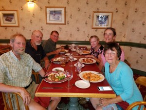
Old Fogeys farewell dinner

Kananaskis Country and Calgary

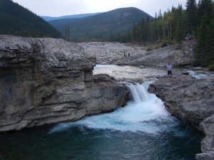
9-10 August:  We said good-bye to Rob & Judith, who were headed north to Wood Buffalo National Park, along the border between Alberta and Northwest Territories, while we headed south for a couple of more days with Dick & Sonia before our paths also diverged.  Our next campground, in McLean Provincial Park, was in the area known as Kananaskis Country, in the foothills on the eastern side of the Rockies, between Banff and Montana.  Although conveniently close to Calgary, this campground would normally have been full of noise, dust, and fumes, because it is a major campground and trailhead for off-highway vehicles.  Fortunately for us, there was a ban in effect for the use of recreational OHVs, due to the danger of sparking additional wildfires.  We enjoyed the quiet by going for a couple of short walks nearby.  The Elbow River flows eastward down from the mountains, and is large enough to provide water to about a third of the entire population of the province of Alberta.  Although Elbow Falls didn’t look very big when we were there, the flow rate varies 100-fold during the year, and the very wide river bed and huge amount of large rounded cobbles indicated how great the spring floods must be.  Forgetmenot Lake was originally a large gravel pit that filled with spring water and now has a decent sized outlet stream despite having negligible flow from inlet streams.

Elbow Falls
Elbow Falls
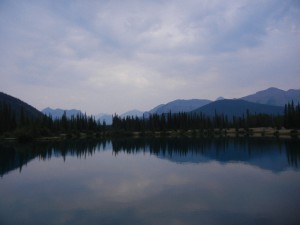
Forgetmenot Lake
Forgetmenot Lake

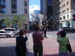
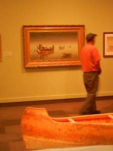
The next day we drove into Calgary and devoted our attention to the Glenbow, a museum of art, cultural history, and natural history.  We went on a tour and talk about the special exhibit by Ken Monkman, a Canadian artist of Cree heritage.  His paintings were large, modern, and even shocking, symbolizing the plight of native people resulting from being colonized, Christianized, urbanized, and modernized.  Many of his works were closely based on well-known classical paintings, with a strong satirical twist.  We had a tasty lunch at a place on Stephen Street, a pedestrian way with lots of restaurants near the Glenbow, then went back in for the rest of the afternoon and focused on exhibits on Northwestern art (the Northwest Territories once included all of what is now western Canada), the romance of canoes (birch bark as well as cedar), the culture of the Blackfeet in particular and First Nations tribes in general.

tourists Sonia, Dick, and Amy in Calgary
Dick perusing the Romancing the Canoe exhibit in the Glanbow museum

Saskatchewan Landing

11-13 August:  After a day of driving across southern Alberta and into southwestern Saskatchewan through wide open vistas of flat, arid, prairie farmland, we camped at Saskatchewan Landing Provincial Park.  The valley of the South Saskatchewan River was carved at the southern margin of the continental ice sheet at the end of the last ice age by torrents of glacial meltwater.  Saskatchewan Landing has served as an important crossing of the South Saskatchewan for centuries (perhaps for millennia).  Nomadic natives of the plains, European fur trappers, mixed blood Métis, homesteaders, and ranchers at various times used this area.  A long reach of the South Saskatchewan that includes Saskatchewan Landing is now submerged in narrow Diefenbaker Lake, the result of two dams built in the late 1960s to provide flood control, irrigation, power, and recreational boating.  There is a diverse fish fauna in the lake, including sturgeon, whitefish, Rainbow Trout (an introduced species), Goldeye, Northern Pike, Burbot, Yellow Perch, Walleye, and Sauger.

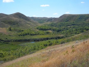
There is noticeably more relief in the river valley than in the surrounding plains.  Besides the valley of the South Saskatchewan itself, there are many small tributary valleys (“coulees”) carved into its sides, forming a complex of valleys and ridges along its course.  Although these coulees have very little water flowing through them now, when the glaciers were melting they were being eroded by powerful rivers of meltwater.  The small springs and creeks remaining in the coulees nowadays are barely sufficient to support shrubs and small trees in this otherwise arid land of grassy plains.

a coulee in the South Saskatchewan River valley
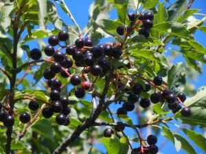
Saskatoon berries
Saskatoon berries
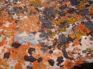
golden moonglow, elegant sunburst, and egg yolk lichens on a boulder left by glaciation
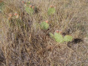
prickly pear cactus on the arid Saskatchewan prairie
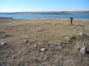
circle of stones left at a teepee site near Saskatchewan Landing

Along Swift Current Creek, a tributary to the South Saskatchewan, the city of Swift Current has parkland and a very nice paved bike path.  Unfortunately, Amy’s bike chain broke again so we only got to explore a small section of the trail.  When a nearby resident walked over to us to offer a ride, we declined so we could walk back on the trail, but lingered for at least a half hour to chat with him.

Manitoba

14-16 August:  Another pretty full day of driving brought us the rest of the way through southern Saskatchewan (stopping in Regina to get Amy’s bike fixed) and into southwestern Manitoba, to Riding Mountain National Park.  This park contains three major ecological zones:  the Manitoba Escarpment, boreal forest, and aspen parkland.  In the visitor center we watched three excellent videos, about moose, the weasel family, and the park itself.  We drove to the eastern end of the park and hiked a trail up the escarpment to Bald Hill, a ridge with steep sides of loose shale, a sharp crest, and a fine view of the prairie in the distance below the escarpment.  The trail up to Bald Hill and back followed the brink of a steep slope beside a stream valley cut into the escarpment, with many good outlooks.  A short loop trail near the trailhead had interpretive signs naming and illustrating many of the local plants.  The day was cloudy and mostly we were hiking among deciduous trees and shrubs, which gave us a distinct feeling that we were indeed well on our way home to New England after many spending most of the summer in the West.

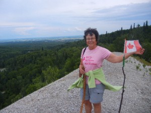
on the summit of Bald Hill near the top of the Manitoba Escarpment in Riding Mountain National Park
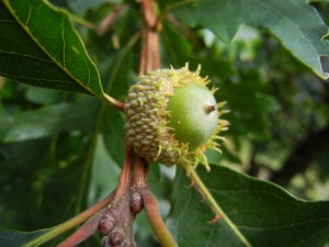
burr oak acorn
burr oak acorn
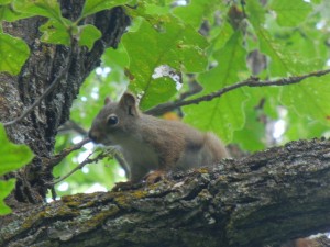
red squirrel scolding us as we hike by

From Riding Mountain NP, we drove east across Manitoba farmlands to Birds Hill Provincial Park, a little northeast of Winnipeg.  Our objective there was biking, and Birds Hill PP is great for that.  There are many kilometers of both paved and unpaved bike paths.  We wound through woods and fields, past a swimming beach and a lookout, and took the connector trail over a major highway on a bike bridge to the Duff Robin Parkway, which is a gravel bike path beside the floodway that was built to provide flood control for the Red River.  In 1950, the Red River flood caused Canada’s worst natural disaster.  The floodway that was built in the 1960s is a gated channel that allows floodwater to be diverted from the main channel of the Red River during extreme flood events.  At the time it was built, it was the second largest earthmoving project in the world, second only to the Panama Canal.  The system proved its worth in 1997, the year when a 100-year flood of the Red River devastated Grand Forks, S.D., and East Grand Forks, Minn., upstream of Winnipeg.  The floodway was later improved to withstand even a worse flood than that.  The connector trail that we rode crosses the floodway on a floating bridge that is open to biking except during flooding events when the floodway is in operation.

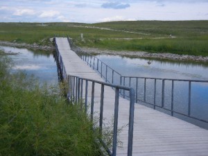
floating bridge for bikes over the floodway

Minnesota

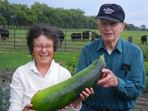
17-19 August:  We dipped south of the border to central Minnesota and paid a visit to Jack, Kyle’s grandfather (Corwyn’s great grandfather).  In his early 90s and a widower since 2004, Jack lives by himself on the farm where he was born and later he and his wife Alice raised three sons.  He introduced us to some of his friends and neighbors as they gathered for coffee in the tiny nearby village of Nimrod.  On the way home we stopped by a neighbor’s to pick some sweet corn for supper, and then Jack showed us around his garden, where we picked about a half dozen huge but still tender zucchini, and his back fields, which are rented out now that Jack has retired from dairy farming.  He told us a bit about the old days while Amy cooked stuffed zucchini to go with the corn, and we generally had a great visit with our genial and humble host.

Amy helping Jack pick zucchini from his garden

The next day we hadn’t scheduled any specific activities and didn’t have campground reservations, so we just headed out to see what we could find.  We passed through the busy tourist town of Walker and kept going north until we found a nice Forest Service campground on a lake with a bike trail around it.  We had a pleasant ride on the Mi-Gi-Zi bike trail around Pike Bay, followed by a swim in its clear water.  In the morning, after chatting a while with the couple camped across from us, we headed for Wisconsin.

Wisconsin

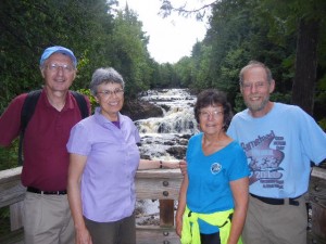
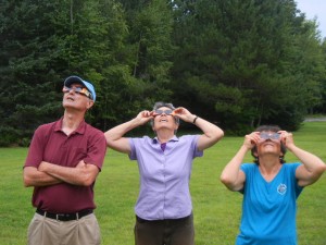
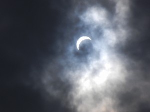
20-23 August:  For our first time camping in Wisconsin, we hiked, biked, and visited with two of Amy’s college friends in the northern part of the state, which is mainly forested with a lot of lakes.  We joined Ann & Gary, who live in St. Paul, Minn., at Copper Falls State Park.  The park’s namesake waterfalls are indeed coppery colored, but that’s due to tannin in the water—the name actually reflects early copper mining activity in the area.  The Bad River was able to erode a deep gorge, where the falls are, because the river follows cracks of a fault line.  The Tyler Forks, however, had to cut across the fault cracks, so it was not eroded nearly so deeply and it plunges over a 30-foot waterfall where it enters the Bad River gorge.  After viewing the falls we looked for the solar eclipse, which was about 80-90% in this area.  It was totally overcast, but we got some brief glimpses of the narrow crescent of the sun through thin spots in the clouds.

with Gary & Ann on the Copper Falls trail
looking for the eclipse
our ephemeral view of the eclipse

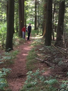
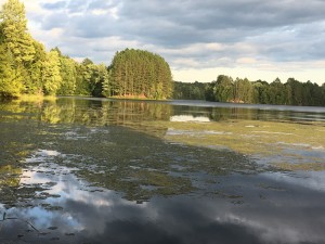
We next relocated to the Spearhead Point campground on Mondeaux Flowage, located along the Ice Age Trail.  This is a National Scenic Trail entirely within the state of Wisconsin that generally follows the terminal moraine of the last glaciation (the Wisconsin Glaciation).  The afternoon we arrived we hiked in one direction on the Ice Age Trail (picking some blackberries for our next breakfast), and the next day we hiked in the other direction.  For about seven miles, the trail follows the crest of an esker, a steep-sided ridge formed by a river depositing sand and gravel as it flows in a tunnel beneath the ice sheet.  This section of the Ice Age Trail was very pleasant indeed.

the Ice Age Trail along the top of an esker
view from our campsite at Spearhead Point on Mondeaux Flowage

24-26 August:  After Ann & Gary had left, we moved northeast to explore some more biking and hiking trails in Wisconsin’s north woods.  This was once a thriving logging region, until most of the big white pines had been cut down.  The forests are a mix of spruce, fir, hemlock, pine (mostly red pine nowadays), and hardwoods such as birch and maple.  Most of Wisconsin’s farmland is farther south.  The terrain is relatively flat and there are many lakes, making this a popular vacation area for people in cities like Milwaukee and Green Bay.  We biked on the Bearskin State Trail, a bike trail on an old railroad grade.  It has several trestle bridges, over the winding course of the Bearskin Creek and also over some of the many swampy and boggy areas.  One time a locomotive and three cars derailed and tipped over beside the rail bed.  Two cranes were brought in to attempt to haul them out of the bog, but one of the cranes also fell in and they had to give up.  The crane, locomotive, and three cars have since sunken far below the surface (some bogs are as deep as 50 feet!).

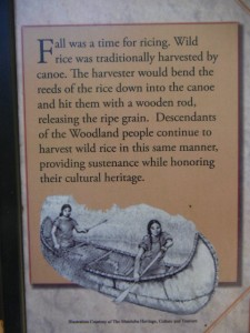
From our campsite on White Deer Lake we hiked around Luna and White Deer Lakes and also a bit of the Hidden Lakes Trail, to Butternut Lake.  This area has yielded artifacts such as pottery and stone and copper tools of the Woodland people, also known as the Archaic Tradition, whose living descendants include the Annishinabe (Ojibwe), Menominee, Potawatomi, and other tribes.

one small panel from an excellent sign on the Hidden Lakes Trail
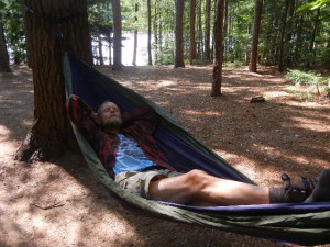
relaxing at White Deer Lake
view from the hammock

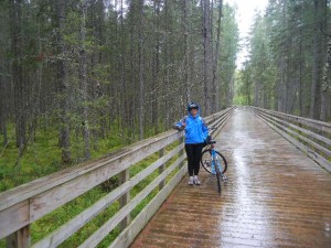
After over four months of dry weather for all of our hiking and biking, our luck finally ran out on a bike ride on the Three Eagle Trail.  After biking 12.7 miles from the north end in Eagle River to the south end in Three Lakes, it started to rain as we ate lunch before biking back and a steady drizzle continued the rest of the day.  It was a fine ride nonetheless.  This trail is partly a rail trail, partly a cross-country ski trail, and partly on quiet rural roads.  It is mostly out of earshot of cars and passes through very pretty woods, with views of lakes and bogs.

crossing the Black Spruce Boardwalk over a sphagnum bog in the rain
along the Three Eagle bike path

Upper Michigan

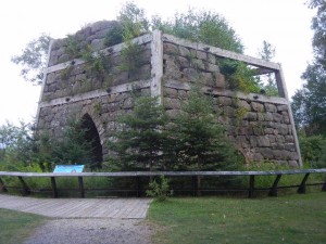
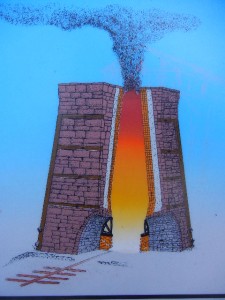
27-30 August:  On our way through Michigan’s Upper Peninsula, we camped for two nights near Lake Superior and two nights near Lake Michigan.  Pictured Rocks National Lakeshore stretches some 40 miles along the southern shore of Lake Superior.  Next to our campground was the historical site of Bay Furnace, the ruins of a blast furnace used to produce iron from 1870 until 1877, when it was destroyed by fire.  Bay Furnace is one of only two remaining examples of the 29 blast furnaces from that period in Upper Michigan.  Its location provided a sheltered anchorage for ships and access to abundant maple and beech trees for producing the charcoal that fueled the furnace.

iron blast furnace ruins at Bay Furnace
diagram of the blast furnace when it was operating

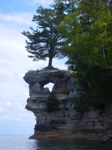
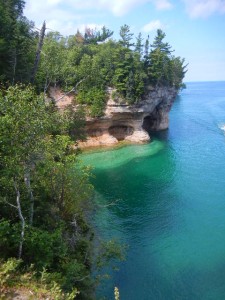
We spent a memorable day hiking around a loop that included about four miles of the Lakeshore Trail (also part of the North Country Trail) in one of the most dramatic parts of the Pictured Rocks shoreline, between Chapel Rock (an interesting rock pillar with arches through it and a white pine tree growing on top of it) and the Mosquito River.  That section of trail follows the edge of the cliffs, with frequent views of rocky headlands, coves, arches, and grottos formed from colorful sedimentary rocks.

trail to Chapel Falls, Chapel Rock, and Chapel Beach
Chapel Rock
Chapel Rock
typical scenery along the Lakeshore Trail

Our next campsite was on Brevoort Lake, near the shore of Lake Michigan.  On the day we arrived there we went for a short hike on the nearby Ridge Trail, which followed the narrow crest of a steep-sided and very winding ridge next to the campground (another glacial esker, no doubt).  Amy swam in Lake Michigan after having swum in Lake Superior the day before, and began to wonder how many of the remaining three Great Lakes she might be able to swim in before we get home.  The water was definitely warmer in Lake Michigan than in Lake Superior (Paul decided to wait for sunnier and warmer weather for him to take the plunge).  Our principal motive for camping at Brevoort Lake, though, was to camp close to Mackinac Island.

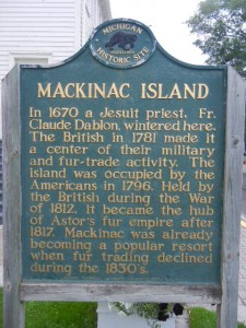
Mackinac Island has long been valued by Native Americans and Europeans alike for its strategic location in the Mackinac Straits where Lake Michigan flows into Lake Huron, close to Lake Superior, providing water routes to the south, east, and west.  For the Anishnaabeck people (Ottawa, Ojibway, and Potawatomi tribes) the island was used as a neutral location for trading, fishing, and ceremonial burials rather than for permanent settlements.  During the late 1600s through late 1700s, French trappers, traders, and missionaries used the island until it came into English possession following the French and Indian War.  Then the Americans took possession after winning the Revolutionary War.  England took the island back in a surprise raid during the early part of the War of 1812, but it reverted to America again in 1815 when the war ended.  The island became a popular resort destination soon afterward (well before the Civil War).  In the 1890s, cars were banned, and they are still banned today.  We took a ferry from St. Ignace on the mainland to Mackinac Island and took our bikes.  There are paved roads, but they are used solely by bicycles and horses, by both residents and tourists (including the eight-mile-long Michigan State Highway 185 that we rode around the entire perimeter of the island).  Besides the typical tourist amenities such as restaurants, hotels and cottages, museums, and gift shops, Mackinac has a number of hand-made fudge shops, a local specialty.

aboard the ferry to Mackinac Island
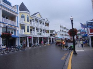
bike and horse traffic only on Mackinac Island streets
brief history of Mackinac Island

Chutes and ladders

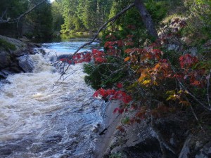
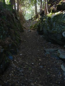
31 August-1 September:  From Upper Michigan, we crossed into Ontario at Sault Ste. Marie and drove eastward in flat terrain north of Lake Huron to Chutes Provincial Park.  This park was named for the chutes built by logging companies in the late 1800s to float their logs down the steep sections of river valleys, passing rapids and falls that would have obstructed the log drives.  A short and scenic hiking trail took us from the campground up one bank of the Aux Sables River and down the opposite bank, past numerous rapids and falls.  We noticed a ravine to one side of the trail that looked as if it had been cut through the bedrock.  It occurred to Amy that maybe it was the route of one of the old logging chutes.  Sure enough, a closer look revealed a nearby water inlet structure in line with it, and it was headed toward a gentle slope leading toward a pool at the base of a large set of rapids, so although there was no identification sign, it was undoubtedly the route of a logging chute from about a century ago.

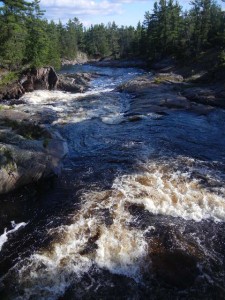
rapids on the Aux Sables River
a touch of fall color
ravine cut through bedrock for a logging chute

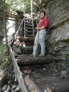
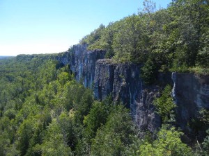
We next drove over a causeway onto the world’s largest island in a freshwater lake, Manitoulin Island.  There we hiked the Cup and Saucer Trail, which climbs up onto and along the rim of vertical cliffs that are part of the Manitoulin extension of the Niagara Escarpment.  This is a very popular trail that was closed by the landowner in early May, but fortunately re-opened less than a month later after the trailhead had been relocated to a new parking lot.  There are ladders on a few of the steeper sections of the trail.  Most hikers apparently go only as far as the East Overlook, because we didn’t see anyone while we hiked a loop farther south along the Escarpment.

a ladder on the Cup and Saucer Trail
The Cup and Saucer trail follows the rim of the Niagara Escarpment