11-12 August: Our next camping destination was Bryce Canyon National Park in southern Utah. A while after leaving the bleak landscape between Green River and Goblin Valley behind us, the scenery began to get interesting. We passed occasional rocky buttes first, then threaded our way between the colorful and tall sandstone cliffs of Capitol Reef National Park.
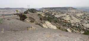
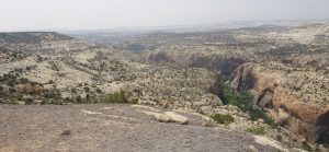
Next, we ascended onto a high pine-covered plateau before the highway emerged along the narrow crest of a high rocky ridge between two vast and deep valleys. This was the justly famed “Hogback” stretch of Highway 12 along the “Devil’s Backbone,” a truly awesome vista said to be one of the most scenic drives in the country, between Boulder and Escalante, Utah. About 40 miles of Hwy 12 follows the route taken by Maj. John Wesley Powell in 1872 during his mapping expedition to fill in the “last blank spot on the map” of the continental U.S.
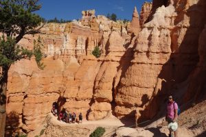
It had been 37 years since we had first visited Bryce, and it was nice to get back. The air seemed relatively cool and clear, due to the high elevation and the lack of thick haze from Pacific Northwest wildfires that had obscured the mountains from our view while in the Denver area. We hiked down from the rim of the plateau into the Bryce Amphitheater section of the park where the ornately eroded hoodoos are impressively clustered together along the face of the pink cliff formation, and then we continued around a loop trail that ascended through a tall slot canyon back to the rim of the plateau.


