Colorado Springs

4-6 Sep:  After leaving Lowry & Kyle’s, we headed south to the Colorado Springs area to visit Amy’s brother Bill, who had recently moved there with his wife Deb from Spokane, Wash., to be near their daughter Hannah, son-in-law Scott, and baby granddaughter Adelai, Corwyn’s newest second cousin.  Lowry and Corwyn traveled with us, with Kyle to join us a day later.  Our trip took longer than expected due to (1) an expensive repair to address an issue diagnosed by a Toyota dealership after dashboard warning lights came on during the drive and (2) very rough unpaved roads into the Pike National Forest campground that we had selected.  The Meadows Ridge campground was very scenic and quiet, with a view of Pike’s Peak, but we decided to relocate the next day to a much more accessible private campground.

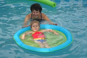
We met Bill & Deb and Hannah & Scott at the Cheyenne Mountain Zoo in Colorado Springs the next day.  It was so hot that one of the memorable things about the zoo that day was pausing often to stop in front of misting machines that cooled off people passing by.  The zoo has over a dozen giraffes, and the walkways past them are at giraffe head level, so onlookers are really close to them.  The Lone Duck Campground (our new one) had a pool, which was well appreciated on this hot day.

Misters were a big hit on a hot day at the Cheyenne Mountain Zoo
Cooling off at the Lone Duck Campground

Before leaving the area the next day, we visited Bill & Deb at their new home, a very attractive and fairly new town house with a high deck out back and a large guest suite in the walk-out basement, which Hannah & Scott recently moved into.  Bill took Kyle, Paul, and Amy on a bike ride up along Cottonwood Creek on part of the city’s extensive greenway bike path network.

Corwyn meets Adelai her newest second cousin


Florissant Fossil Beds & Black Canyon

7-9 Sep:  We five were joined in Mueller State Park by long-time hiking and camping friends Dick & Sonia.  Mueller not only provided camping close to Florissant Fossil Beds National Monument, but it offers pleasant hiking trails in an attractive location high on a ridge amidst pine forest, grassy meadows, and mountain vistas.

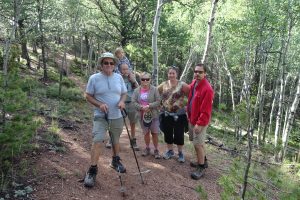
Hiking in Mueller State Park

Many excellent specimens of insect and plant fossils have been found at Florissant.  They date back about 34 million years, when there was a lake in the area and the climate was not as dry as today.  Although the fossils we saw were limited to those displayed in the visitor center, visitors can walk around huge fossilized stumps of redwood trees from that earlier time.  Ash deposits from large volcanic eruptions buried the bottom of the redwoods, and later the stumps were fossilized when permeated by silica-rich water.  We hiked through a pleasant landscape over a ridge and through a valley floor past the original log house of the widow Adeline Hornbek, whose first husband died and second husband disappeared, leaving her alone with four children.  She not only made a go of it, but prospered in that frontier setting.

Petrified redwood stump at Florissant Fossil Beds NM

Next, we all relocated to the Black Canyon of the Gunnison National Park.  This canyon, carved by the Gunnison River, is renowned for its steep stream gradient, sheer walls, narrowness, and great depth.  It was named the Black Canyon because parts of the canyon bottom receive very little direct sunlight.  It took a major feat of construction to build a railroad as far down the canyon as the town of Cimarron, but efforts to go farther were stymied, so the railroad had to be built away from the river beyond that point.  In addition to short walks out to viewpoints along the canyon rim, we hiked the two-mile Oak Flat Loop trail, which descends part way below the rim but not all the way to the river, and the Rim Rock Trail between the visitor center and the campground.

Grabas & Lindsays at Black Canyon NP
Dick & Sonia hiking the rim of the Gunnison’s Black Canyon


Canyons of the Ancients

10 Sep:  After our Coloradan family and friends headed back to their homes, we started heading toward states we hadn’t traveled in before.  On the way south from Black Canyon, we drove past Telluride in the scenic San Juan Mountains.  In its early days, Telluride was a mining town, not the glamorous ski destination it is today.  Roadside plaques told us of events like when Butch Cassidy began his notorious outlaw career by robbing a bank in Telluride and when AC electricity (promoted by George Westinghouse and Nikola Tesla) was chosen instead of DC (promoted by Thomas Edison) for the first commercial generating plant in the U.S. (Ames Power Plant) to provide power to operate the Gold King Mill.

Mountain vista at Lizard Pass in the San Juan Mountains

The Canyons of the Ancients National Monument visitor center and museum near Dolores, Colo., was built as a repository for the large number of artifacts found during 1978-1983 by archaeologists in the area to be flooded by a dam on the Dolores River.  The visitor center exhibits give an excellent overview of ancient cultures of Ancestral Pueblo people in the four corners area.  A short self-guided nature trail leads from the visitor center to an ancient ruin atop a hill overlooking the reservoir.

Competing theories of how humans first came to the Americas

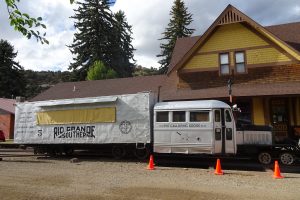
Also in the town of Dolores we went to the small free railroad museum dedicated to the Galloping Goose.  This was a series of small rail cars, powered by automobile or truck engines rather than by the earlier steam locomotives, that provided mail service on the narrow gauge railway from Durango to Ridgway in the 1930s to the early 1950s.

Galloping Goose at the railroad museum in Dolores


Chaco and Bandelier: Ancestral Pueblo Ruins

11-12 Sep:  Chaco Culture National Historical Park was our number one goal of sights to see in New Mexico.  On the drive south from Colo. we stopped for lunch at the Farmington, N.Mex. visitor center & museum, where there was a beautifully landscaped picnic area and a traveling exhibit of exquisite quilted wall hangings on the theme of the Rio Grande River.  We browsed a couple of Navajo art galleries and selected a small Navajo rug for our living room.  Our Chaco adventure truly started as we traveled the long unpaved road from a major state highway in toward the park.  For a while it was not too bad, merely a somewhat rough gravel road, but after leaving the section maintained by the county, it became atrociously rough and washboarded.

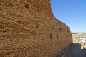
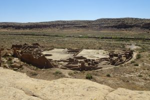
The tortuous ride was worth it, though.  The “great houses” built by the Ancestral Pueblo people in the late first and early second millennia were expertly crafted of sandstone bricks and mortar into multi-story pueblo-style apartment complexes, the largest and best example being Pueblo Bonito.  Despite the arid environment, the Chaco Culture thrived as a major ceremonial population center with trade connections to places as far away as today’s southern Mexico.

Chacoan wall
Pueblo Bonito

13-14 Sep:  Between Chaco and our next stop, Bandelier National Monument, we traveled through canyons, wooded mountains, and along the rim of a large, ancient volcanic caldera by way of the very scenic Highway 4.  The Jemez volcano erupted at least twice in violent eruptions 600 times the force of the 1980 Mount St. Helens eruption.  The emptied magma chamber collapsed, forming the 14-mile wide Valles Caldera.  Ash deposits from Jemez and other volcanic eruptions of the period compressed during subsequent millennia into beds of volcanic tuff, a fairly soft conglomerate rock, over 1,000 feet thick in places.

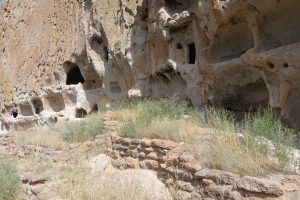
In the Frijoles Creek valley, the Ancestral Pueblo built “talus” dwellings at the base of the steep cliffs by hand digging small caves (“cavates”) into the tuff for inner rooms and constructing outer rooms in the pueblo style using blocks of tuff.  The Main Loop hiking trail in the monument passes a traditional pueblo on the valley floor as well as talus dwellings along the base of the cliff, with numbered stops corresponding to an informative pamphlet explaining the geologic, cultural, and natural history along the way.  The Long House section of talus dwelling ruins shows clearly the hand-carved holes where roof and floor beams were once erected for two and three-story dwellings in a continuous structure along the base of the cliff.

Long House at Bandelier


Santa Fe

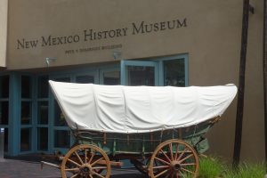
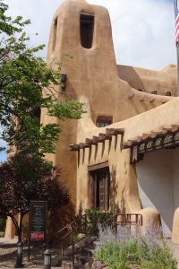
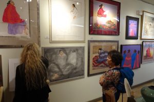
15-16 Sep:  Our focus in Santa Fe was museums and art galleries.  We visited the Indian Art and Culture Museum & the International Folk Art Museum one day and the New Mexico History Museum & the New Mexico Art Museum the next.  Our tour guide in the history museum gave us a thoroughly interesting and informative summary of some of the significant events and famous people in the state’s history, such as the Pueblo Revolt and Billy the Kid, and an appreciation of the influential cultural factors behind them.  The museum area in the old part of Santa Fe showcases the traditional pueblo building style of the region.  We also went through the gallery of Navajo artist R.C. Gorman, whose work we were introduced to by the collection of his art displayed in a restaurant back in New Hampshire.

New Mexico History Museum
New Mexico Art Museum
Admiring R.C. Gorman paintings


Kasha-Katuwe Tent Rocks National Monument

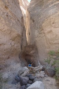
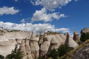
17 Sep:  Between Santa Fe and Albuquerque we stopped at Tent Rocks.  For a relatively short hike of three miles, this rewarded us with some fabulous scenery.  The same thick volcanic tuff that we saw at Bandelier has been eroded here into the teepee-shaped cones that give the monument the English part of its name.  Kasha-Katuwe means white cliff in one of the local Native American languages.  The conical formations resulted because they are topped by small capstones that are more resistant to weathering than the softer tuff below.  Some of the tent rocks can be seen from below at a distance, but after hiking through a narrow slot canyon the trail climbs among and then above the tent rocks to the top of a ridge with views of distant mountains.

Amy entering the slot canyon
Tent Rocks

Albuquerque

18 Sep:  We had a day to spend in Albuquerque, and made the most of it.  First, we rode on the Paseo del Bosque bike trail, which follows a greenway along the Rio Grande.  For much of our ride we biked beside a large, straight irrigation ditch and the river itself was hidden from our view by trees and bushes.  We did, however, have one good view of the Sandia mountain crest, which dominates the view east of the city, and where we were camped in a nice private campground.  The Rio Grande through Albuquerque has been heavily modified since the turn of the 20th century, straightening the main channel and providing a network of irrigation channels.  Recently there have been efforts to allow flood debris such as trees, brush, and soil to accumulate and build more natural and well-vegetated river banks.  We turned off the main trail for a while to ride a small unpaved loop close to the river in the very pleasant Aldo Leopold Woods, which had several historical signs explaining Leopold’s career and philosophy.  Trained in forestry, he was a pioneering voice in the fields of wildlife management and environmental ethics.

View of the Sandia mountain crest from the bike trail

In the early afternoon we went through the Indian Pueblo Cultural Center.  Exhibits there told of ancient cultures, historical events, and way of life of the Pueblo Indians of the region, with some very fine examples of Pueblo art on display, including pottery by some of the most talented artists, such as Maria Martinez.  She was known for her signature black pottery, created by carefully controlling the conditions and timing of the firing of her pottery.

Exquisite Pueblo pottery at the Cultural Center

The highlight of our day in Albuquerque was meeting and spending time with Paul’s third cousin Dennis and his wife Lou, long-time Albuquerque residents.  Dennis and Paul had never met before, even though their great grandparents were siblings of the Lowry family raised in the Boston area by parents who had emigrated from County Down in northern Ireland.  We met for lunch and later in the afternoon visited them in their home.  Dennis is an artist; we were very impressed by several of his large and intricately detailed western landscape paintings hanging in his studio.  Lou is a former teacher and both of them are avid readers.  We had a most enjoyable time visiting with them, and now feel we have yet another reason to make sure we get back to New Mexico again.

Our new friends in Albuquerque, Lou & Dennis
Dennis at his easel

Valley of Fires Recreation Area & White Sands National Monument

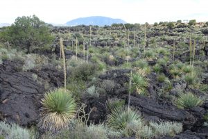
19 Sep:  Driving from Albuquerque toward White Sands, we looked for a good spot to stop for our picnic lunch and happened upon the Valley of Fires Recreation Area.  A picnic area and campground there overlook one of the most recent lava flows in the U.S. (about 5,000 years ago).  The Malpais Lava Flow erupted from a small vent (Little Black Peak) and spread for a distance of about 40 miles in the Tularosa basin, covering 125 square miles up to 160 feet thick in places.  A self-guided nature trail took us over the lava and identified many of the plants and wildlife that have managed to colonize the flow, which still looks black and barren from a distance.  This walk gave us a good introduction to several Chihuahuan Desert plants that we would see more of in days to come.  One in particular, sotol, was especially prominent, with its yucca-like base and very tall flower stalk.

Malpais Lava Flow, with its vent visible on the horizon
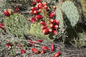
Prickly pear cactus loaded with fruit
Desert plants colonizing lava

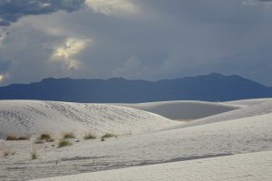
We arrived at White Sands National Monument late in the afternoon, with just enough time to go through the visitor center, drive the scenic road, walk a few minutes on some large dunes, and join a sunset ranger-led walk.  White Sands is the world’s largest gypsum dune field.  The grains of gypsum resulted from weathering breakdown of selenite crystals.  The ranger leading our walk pointed out a white lizard, adapted to living on these pure white dunes.

White Sands dunes
Selenite crystals like this eroded into gypsum sand

Organ Mountains-Desert Peaks National Monument

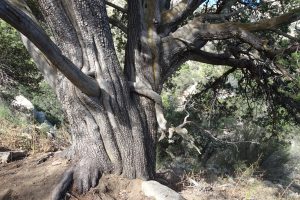
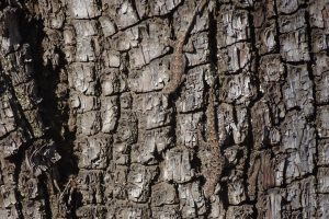
20 Sep:  We had arrived at our next destination well after dark after our sunset walk at White Sands, so we had no idea what our campground looked like until morning.  We awoke to find that our site at Aguirre Spring in the Organ Mountains had a wonderful view of a jagged mountain crest to our west and a far off glimpse of the dunes of White Sands below to the east.  We hiked the four-mile Pine Loop Trail, which climbed to a low pass with a good view south, then circled clockwise through an area with several large pines before descending back to the campground.  Most trees were not very tall or closely spaced, so the trail continually offered good scenery.  The two kinds of trees that seemed dominant here were alligator juniper and gray oak.  Many of the junipers looked pretty old, with thick trunks and scaly bark that looks like alligator hide.  We often sighted lizards along the trail.  The trail was fairly rugged, so we didn’t hurry and took about four hours to finish our hike, a most satisfying outing in a gorgeous setting.

Campsite in the Organ Mountains
Large old alligator juniper tree
Two lizards on the bark at the base of the tree in the previous photo

Carlsbad Caverns National Park

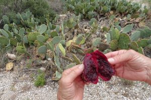
21 Sep:  Our last objective in New Mexico on this trip was Carlsbad Caverns.  The road into the park winds through hilly terrain as it ascends onto a plateau where the cave is.  At an overlook on the way in, where we had stopped to read the sign describing the archaeological evidence of an ancient camp inside a rock alcove, a teacher there with her family showed us how to slice open a prickly pear cactus fruit and scoop out the inside to eat.  Although the outside of the fruit has tiny prickly spines on it, the pulp inside was juicy and sweet.

Tasting the juicy prickly pear fruit

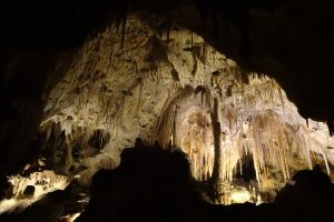
Carlsbad Cavern is a very large limestone cave with an optional trail entering the natural entrance and descending to the large caverns below and a main trail circling through the Big Room that can be accessed either by elevator or the natural entrance trail.  The trails are made for self-guided touring, with signs and audio guides providing details of the formations and the history of the cave.  We felt that Carlsbad compared very favorably with the other caves in national parks & monuments we have toured through.  The variety, beauty, and scale of the formations are very impressive.  The key features are highlighted tastefully with accent lighting, while maintaining a dimly lit cave experience.

Descent through the natural cave entrance
Large intricate formation
Delicate stalactites in an alcove