Chutes and ladders

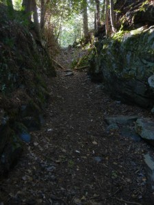
31 August-1 September:  From Upper Michigan, we crossed into Ontario at Sault Ste. Marie and drove eastward in flat terrain north of Lake Huron to Chutes Provincial Park.  This park was named for the chutes built by logging companies in the late 1800s to float their logs down the steep sections of river valleys, passing rapids and falls that would have obstructed the log drives.  A short and scenic hiking trail took us from the campground up one bank of the Aux Sables River and down the opposite bank, past numerous rapids and falls.  We noticed a ravine to one side of the trail that looked as if it had been cut through the bedrock.  It occurred to Amy that maybe it was the route of one of the old logging chutes.  Sure enough, a closer look revealed a nearby water inlet structure in line with it, and it was headed toward a gentle slope leading toward a pool at the base of a large set of rapids, so although there was no identification sign, it was undoubtedly the route of a logging chute from about a century ago.
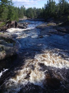
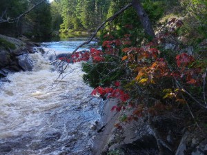
rapids on the Aux Sables River
a touch of fall color
ravine cut through bedrock for a logging chute

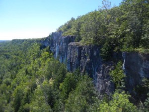
We next drove over a causeway onto the world’s largest island in a freshwater lake, Manitoulin Island.  There we hiked the Cup and Saucer Trail, which climbs up onto and along the rim of vertical cliffs that are part of the Manitoulin extension of the Niagara Escarpment.  This is a very popular trail that was closed by the landowner in early May, but fortunately re-opened less than a month later after the trailhead had been relocated to a new parking lot.  There are ladders on a few of the steeper sections of the trail.  Most hikers apparently go only as far as the East Overlook, because we didn’t see anyone while we hiked a loop farther south along the Escarpment.
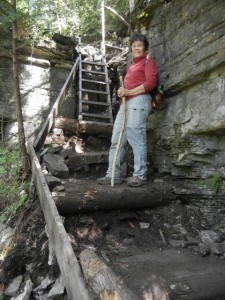
a ladder on the Cup and Saucer Trail
The Cup and Saucer trail follows the rim of the Niagara Escarpment

Pow Wow

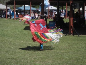
2 September:  The town of M’Chigeeng on Manitoulin Island was holding its annual Pow Wow on this day, so we went to see it.  Ojibway account for a fairly large proportion of Manitoulin’s population.  Along with allied tribes who speak related Algonquian languages, they have long been predominant in the northern Great Lakes region.  They were one of the earlier tribes to acquire guns from Europeans, forced tribes such as the Sioux to move farther west, and successfully fended off their enemies the Iroquois from farther east.  We had been traveling through the traditional land of the Ojibway (sometimes called Chippewa, especially in the U.S.) in Manitoba, Minnesota, Wisconsin, and upper Michigan on our way to Ontario.

The M’Chigeeng Pow Wow was something like a town fair, with booths selling food and handcrafted items.  The focal event for the afternoon was an opening procession of dignitaries in ceremonial regalia followed by various groups of dancers, each to the accompaniment of drums and chanting.  The dancers, including both genders and a wide range of ages, were dressed in traditional costumes and danced in a circle around the bandstand inside a wider circle of benches holding the spectators.  The costumes were not limited to buckskins and eagle feather headdresses, but displayed a wide range of styles and colors.  This was especially true for the women.  In one dance they twirled around holding large colorful shawls.  In another they wore “jingle dresses” hung with dozens of small bells (traditionally fashioned from pieces of tin cans rolled into a narrow cone shape).  Although the Pow Wow does provide a show for tourists, more importantly it is a traditional way for the local community to gather together, keep some of their traditional customs alive, and honor those who have given significant local and national service.  For lunch we bought a nish taco, which is a fried-dough “scone” topped with a hot tomato-based sauce, with typical taco toppings such as tomato, lettuce, meat, and cheese sprinkled on top (one was large enough for the both of us).DSCN9899DSCN9900DSCN9904

Bruce Peninsula

3-4 September:  After a ferry ride from Manitoulin Island to the northern tip of the Bruce Peninsula, we camped two nights in Bruce Peninsula National Park.  The Bruce Trail, a public footpath following the edge of the Niagara Escarpment from the Niagara River to Tobermory (where our ferry landed), is over 550 miles long and passes through Bruce Peninsula National Park along the shore of Lake Huron’s Georgian Bay.  The Niagara Escarpment was not formed by a fault, but rather by differential erosion in which the upper side was protected by a resistant layer of dolomitic limestone cap rock.  Its most well-known feature is Niagara Falls, but there are many other stretches of prominent cliffs along its length.

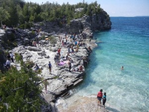
Labour Day weekend crowds near the Grotto at Bruce Peninsula National Park
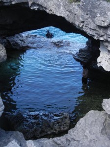
the Grotto
the Grotto

Bruce Peninsula NP is one of the four most-visited of all Canadian national parks.  There the Niagara Escarpment forms cliffs along the eastern (Georgian Bay) shoreline of the Bruce Peninsula.  Although the cliffs rising from the lake are impressive, in places the submerged height is even greater.  One particular formation in the park, The Grotto, has become such a popular tourist attraction that the park limited day-use visitors to four hours in the Grotto parking lot during the busy Labour Day weekend while we were there.  The crowds thinned out considerably between Sunday, when we hiked past The Grotto, and Monday, when we hiked another section of the Bruce Trail along the shore (it turned rainy Monday, plus it’s a good half drive for folks returning to the metro Toronto area).

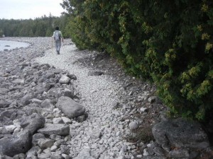
following the Bruce Trail along Georgian Bay
northern cedars are loaded with cones this year

Hockley Valley

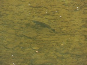
5-7 September:  We headed south, generally following the Niagara Escarpment, to Ontario’s Headwaters region, where the Nottawasaga River (Lake Huron drainage), the Grand River (Lake Erie drainage), and the Credit River (Lake Ontario drainage) originate.  We stopped to bike a section of the Elora Cataract rail trail on our way to visit long-time friends Bob and Paula, who have lived in the Hockley Valley for over 40 years.  An advantage of their house being just a few steps from the Nottawasaga River is that they can look down from their bedroom window to see salmon swimming upriver from Lake Huron to spawn.  A disadvantage is that in unusually wet springs the river can overflow its banks and the rising water table can infiltrate their basement (which happened this year).

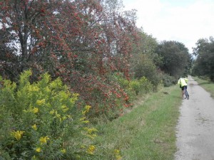
late summer color along the Elora Cataract Trailway
a salmon swimming up the river
a salmon swims up the Nottawasaga River
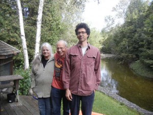
Paula, Bob, and Matthew

Their son Matthew, a philosophy professor who has been teaching at a university in Egypt for the last few years, was home on an extended visit.  We hadn’t seen him since he was in high school, and he told us the happy news that he is engaged to be married.  Bob and Paula’s next door neighbor Fred took us on a very pleasant bike ride along the valley and on the Vicki Barron Lakeside Trail through the Island Lake Conservation Area and around the Orangeville Reservoir.  Fred has been active, both as a volunteer and as an elected town official, in habitat restoration projects on the town conservation land we were riding through.

On a shopping trip into town, Bob and Paula introduced us to a distinctive tradition that Orangeville has embraced.  Instead of completely removing the trees that die along the town streets, a tall stump is left in place and carved into a work of art.  Since 2003, the number of tree sculptures has grown to 55, created by 19 artists plus the Headwaters Carving Club.DSCN9944

DSCN9946

DSCN9948

Gatineau

8-10 September:  The last area we explored on our homeward route was around Canada’s capital, Ottawa.  We camped about a half hour north of the city, in Gatineau Park.  The first day we spent most of our time in the Canadian Museum of History.  This is a large and attractive museum, with so much to see that we concentrated mainly on the First Peoples of the Northwest Coast and First Peoples exhibit halls on the lower level and decided that we would like to come back in the future to go through the upper three floors.

the Canadian Museum of History
Northwest Coast art
Northwest Coast art
The Spirit of Haida Guaii, by Bill Reid

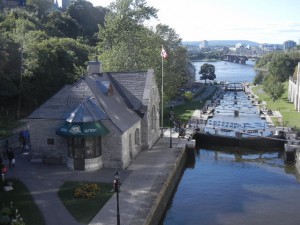
We also very much enjoyed the 45-minute movie Rocky Mountain Express, which told the story of building Canada’s first transcontinental railway through the rugged Canadian Rockies, with beautiful sequences of a restored steam locomotive speeding through spectacular scenery.  This film was particularly meaningful to us after having traveled through Rogers Pass and Kicking Horse Pass this summer.  In the late afternoon we biked around Ottawa’s Capitol Cycle Route, a loop running along the bank of the Rideau Canal, through a residential/industrial area, then back near the Ottawa River and the Parliament buildings.  The canal, built in 1832 in case of war between the U.S. and Canada, connects Ottawa with Lake Ontario and the St. Lawrence River.

the Rideau Canal where it enters the Ottawa River

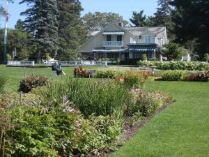
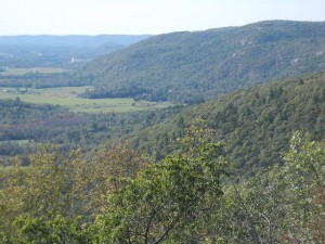
We spent the next day exploring Gatineau Park.  During certain dates and times, the parkway running through it is open only to bicycles and pedestrians, making it a popular destination for cyclists from the nearby capitol region.  This was a Sunday, and some of the most popular trailhead parking lots were full and even overflowing.  We took three short loop hikes.  One led past a waterfall to the beautifully landscaped former estate of William Lyon Mackenzie King, Canada’s Prime Minister during most of the 1920s through 1940s.  Our other two hikes led to viewpoints overlooking the broad plain of the Ottawa River valley from the Eardley Escarpment, which was formed by faulting that lifted the ancient granite of the Canadian Shield followed by erosion of the overlying sedimentary rock during the ice age.

Mackenzie King Estate
the Ottawa river plain meets the Eardley Escarpment

Home again

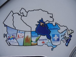
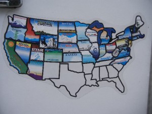
11 September:  Back home after a little over five months away, we have many fond memories of this year’s trip—visiting friends and family; exploring Peru with Abby; camping with Lowry & Kyle and our 9-month-old granddaughter Corwyn; cruising in the San Juan Islands with Gordon; hiking in the majestic Canadian Rockies with OFOC buddies Rob, Judith, Dick, and Sonia; … and the list goes on.  We met many great people in our travels, and nearly everywhere we went we learned about places we hadn’t known about that would be interesting to see on future trips.  Our camper maps on Vagabond now display stickers for all 10 Canadian provinces and 37 of the lower 48 states, but we certainly don’t feel that we are finished traveling to them.  There are plenty more sights, hikes, and bike rides in them tempting us to return.

all 10 provinces
all 10 provinces
37 of the lower 48
37 of the lower 48