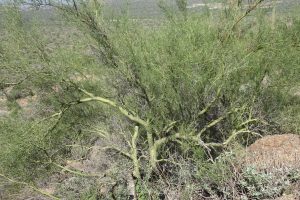
9-13 September: For our trip through Arizona, we focused on the southeastern part of the state. First, we camped and hiked in the Sonora Desert region. The saguaro cactus, which seems so emblematic of Arizona, is widespread in that region. Usery Mountain Regional Park, east of Mesa, is a great spot for camping and hiking in the desert landscape while being close enough to Phoenix for easy access to attractions there. We also got to visit with our friend Bev, who had moved from two houses away from ours on Long Pond to Mesa a couple of years ago. Bev recommended the Wind Cave Trail near our campground, so we hiked that in the morning before the major heat of the day. This popular trail meanders gently up among cacti and desert shrubs and across a rocky slope to a shallow alcove. We stopped along the trail to chat with the park’s friendly and knowledgeable interpretive ranger, “Ranger B,” and learned how to tell a barrel cactus from a saguaro of the same size and about palo verde (“green stick”), Arizona’s state tree. The bark on the trunk and branches of palo verde is indeed bright green; only the thick bark on large trunks of old trees becomes wrinkled and gray. We also learned that Ranger B knows Bev—she does a lot of volunteer work in the park and is a friend and neighbor of his. We spent the afternoon at the Heard Museum in Phoenix, which showcases the arts and cultures of Arizona’s 22 sovereign tribal nations.
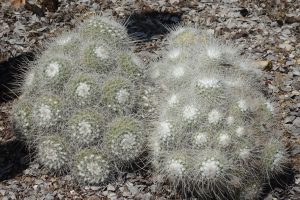
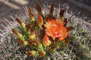
 barrel cactus, ocotillo, and saguaro
Our exploration of Arizona’s desert region next shifted to the Tucson area. On the way there, we stopped to see Casa Grande Ruins National Monument. Although the inside exhibits were closed due to Covid, the self-guided tour of the ruins, with its many informational signs, was well worth seeing. The main structure, built around 1350 and protected by a steel and concrete canopy since 1932, is the ruins of a rectangular building four stories high and 60 feet long, named Casa Grande by the Spanish. This is the largest known structure built in the Sonoran Desert during the Hohokam cultural period. The orientation and openings of the walls are related to astronomical alignments. Surrounding this central building were many much smaller adobe buildings of the village.
People lived in permanent settlements in what is now central and southern Arizona as early as the year 300 and were able to thrive in the desert conditions by building extensive networks of irrigation canals for agriculture (corn, beans, squash, tobacco, cotton, and agave), primarily along the Salt River and Gila River valleys. They traded pottery and jewelry for goods and materials from as far away as California, the Great Plains, the Colorado Plateau, and Mexico, and began to concentrate in large villages like Casa Grande. The Hohokam Classic Period extended from about 1150 until the 1400s, but only ruins were left by the time the first Spanish missionaries arrived in 1694. In 1892, after 200 years of further damage by vandals and souvenir hunters, Casa Grande became the first archaeological reserve in the U.S. Indigenous people living today in this part of the American Southwest are descended from the Ancestral People who once mastered this demanding environment.
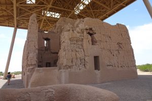 Casa Grande ruins
We camped in Tucson Mountain Park, west of the city. The large campground was almost empty, because their busy season doesn’t usually start until November. From our campsite we had good views of birds, sighting our first Gila woodpeckers and white-winged doves. On a morning run I saw a huge pale green toad or frog (unfortunately, a road kill) and later found out it was a Colorado River toad (aka Sonoran Desert toad). After freshly baked banana bread for breakfast, we spent most of the day at the nearby Arizona Sonora Desert Museum. Part zoo and part botanical garden, there is a wealth of material to see and learn along the attractively landscaped walkways. The cactus garden section was one of the highlights and the docents were very friendly and informative. In the latter part of the afternoon, we went to the western section of Saguaro National Park for the scenic drive and a short hike to see some petroglyphs.
The next day we concentrated on the eastern section of Saguaro NP on the other side of Tucson. After going to the gift shop at the visitor center, we went for a hike up onto the end of a ridge. When we reached a knob on the ridge with a good view, we stopped for lunch and then hiked back down. Then we drove around the scenic drive, which was much more pleasant and scenic than the unpaved scenic loop in the western section of the park. We found a good ice cream shop while driving back across Tucson toward our campground (a welcome treat on a hot day!).

