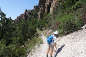
14-15 September: Nestled in the Chiricahua Mountains in the southeastern corner of Arizona, Chiricahua NM was high on our list of eagerly anticipated places to visit on our homeward route from California. Hiking friends Dick and Sonia had told us how beautiful it is, and we were not disappointed. On our way there from Tucson, maps and signboards at the scenic Texas Canyon Rest Area on Interstate 10 gave us some historical perspective of this rugged area known as the last stronghold of the Chiricahua Apache people under their leaders Cochise and Geronimo as they were overwhelmed by the relentless westward invasion of Anglo-American explorers, soldiers, miners, and ranchers into their native homelands.
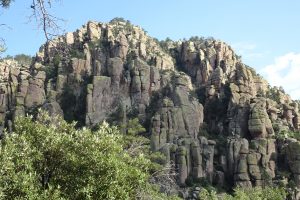
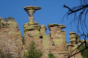
We settled in on arrival day by taking a short afternoon hike up and back the lower part of the little-used Natural Bridge Trail, which quickly led to good views of impressive boulder and rock formations lining the sides of steep canyons winding up into the mountains. The Chiricahua Mountains are a “sky island” (isolated mountain range), with elements of four regional ecosystems (Rocky Mountain species, Sonoran Desert species, Sierra Madrean species, and Chihuahuan Desert species). Superheated ash particles from the Turkey Creek Volcano eruptions 27 million years ago melted together, forming the gray rhyolite rock that weathered during subsequent ages into the intricately eroded rock spires and balanced rocks that these mountains are known for today.

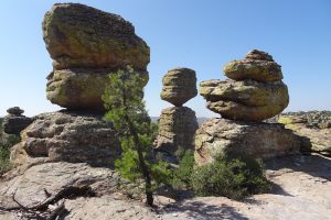

Our main hike in Chiricahua was the next day. We got an early start and drove up the scenic Bonita Canyon Drive to the Echo Canyon trailhead. From there we did an 8.8-mile, out-and-back hike to the Heart of Rocks loop, with a spur to Inspiration Point and a side loop through Echo Canyon. This route led us to some of the most spectacular views in the monument, with minimal elevation gain (we usually don’t reach our summit views as early as 9 am!). The design and construction of the trails are both superb, owing largely to guest ranch manager, preservation advocate, and master trail builder Edward Murray Riggs (1885-1950). National Monument status was awarded in 1924 to protect the pinnacles. A lot of the trail work was accomplished with the help of the CCC in the 1930s.


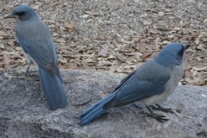
Our most frequent wildlife sighting (apart from the Mexican jays back in the campground) was small lizards that would dart across the trail as we approached. These were Yarrow’s spiny lizards, aka mountain spiny lizards, slender and just a few inches long, with a distinct black collar bordered behind by a narrow white ring. The body scales had a reddish tint to them and the tail had a greenish tint (too quick for us to photograph, though).
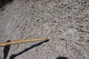
An interesting band of rock along the Hailstone Trail looked like white marble-sized stones stuck together. These are spherulites, once thought to have formed from volcanic ash coalescing around water droplets similar to the way hailstones form. Recent research, however, has failed to find evidence of ash layers in them.
