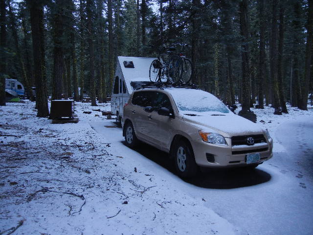
6-8 Jun: On the way to our next camping destination, Lassen Volcanic National Park in northern California, we had overnight stops at Hickison Petroglyph Recreation Area in central Nevada and at the home of friends Esi and Terry in Winters, a little way outside of Sacramento. Hickison has a nice little Bureau of Land Management campground nestled among singleleaf pinyon pines near some petroglyphs and a short interpretive trail to a viewpoint on top of a ridge. We had met Esi and Terry at their home in Asheville, N.C., about a year ago. Since then they moved to California to be close to their daughter, son-in-law, and grandsons. They treated us to a home-cooked Persian supper and took us for a walk along a trail along a creek near their home before we left in the morning.
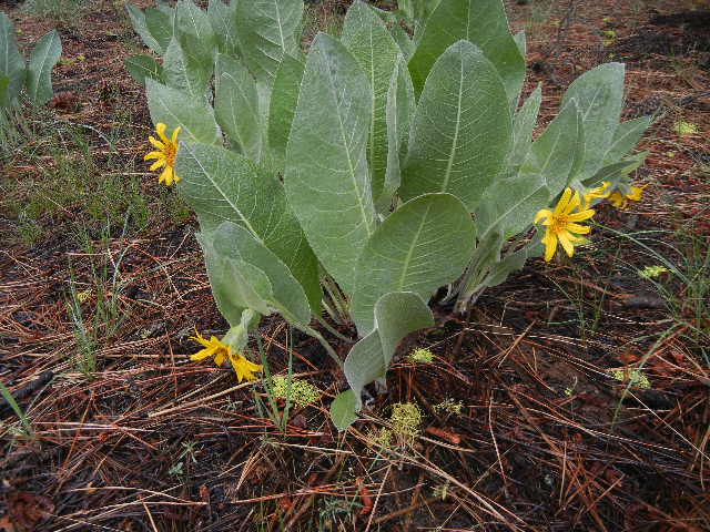
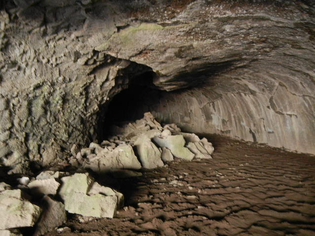
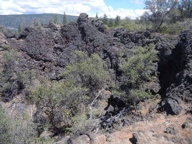
9 Jun: We visited Lassen NP several years ago, mainly hiking in the southern part of the park. This time we camped and hiked in the northern part (the road through the park was still not open for the season). Today’s hikes were two interpretive trails, Subway Cave and Spatter Cones, just outside the national park, in Lassen National Forest. Subway Cave is a lava tube cave, formed when molten lava continued to flow inside after the surface of the flow had cooled enough to solidify. Later the lava drained, leaving a hollow tube. This lava tube cave was pretty large, easily tall enough to walk through and several yards wide. The two-mile-long Spatter Cones interpretive trail looped past several 30,000-year-old examples of columnar jointing, partially collapsed small lava tubes and domes, and rough lava deposits from liquid lava that was ejected into the air and hardened where it fell around the vent to form the spatter cones. There were wildflowers blooming along both trails, among shrubs typical for this fairly arid region.
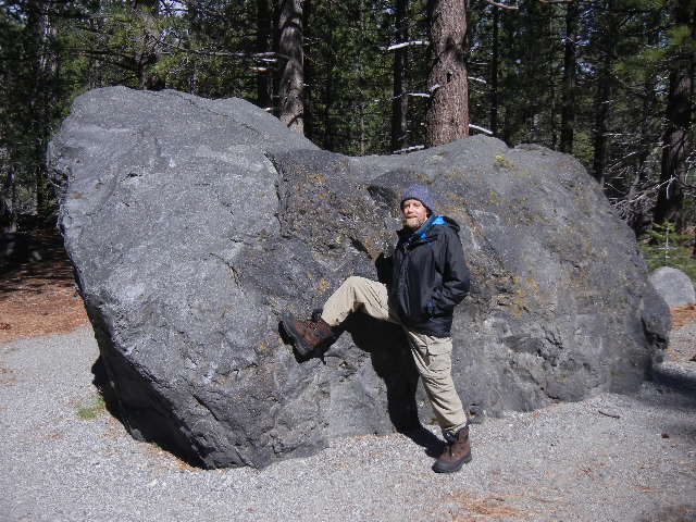
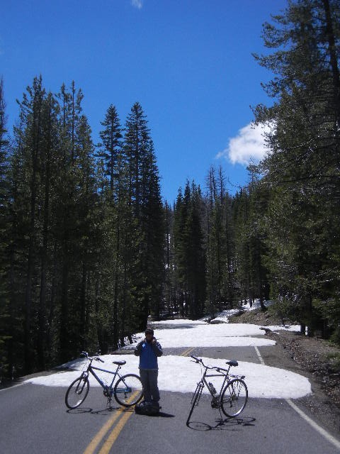
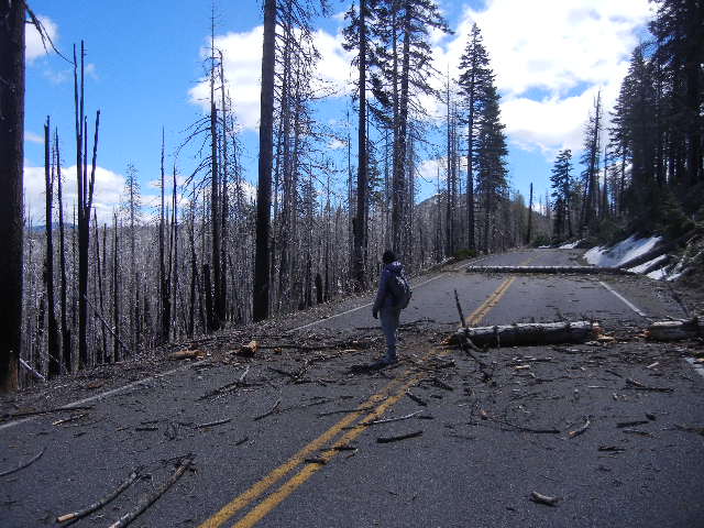
10 Jun: We drove south on the park road as far as it was open, about 10 miles. There we hiked the Devastated Area interpretive trail, which described the eruption and resulting lahar, the destructive mud and debris flow down Lassen’s northeast flank when the hot lava from the May 1915 eruption melted snow around the crater. Lassen’s eruption was the most recent one in the contiguous 48 states until Mount St. Helens erupted in 1980. Not only was the forest obliterated in the path of the lahar, but boulders as large as a small cabin were carried as much as four or five miles from their origin at Lassen’s summit. We explored the park road beyond the closure barrier on our bikes, but soon our way was blocked by large snowdrifts and downed trees across the road. We continued farther on foot, and found ourselves in a burned area that was part of the 36,000 acres burned by a lightning-caused forest fire in 2012. On all our hikes in and around Lassen on this trip we were never far from areas that had obviously been damaged by fires. In the afternoon we hiked up the Manzanita Creek trail from our campground a few miles until the snow cover at higher elevation made hiking more difficult.
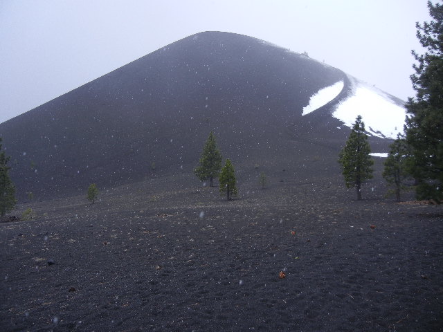
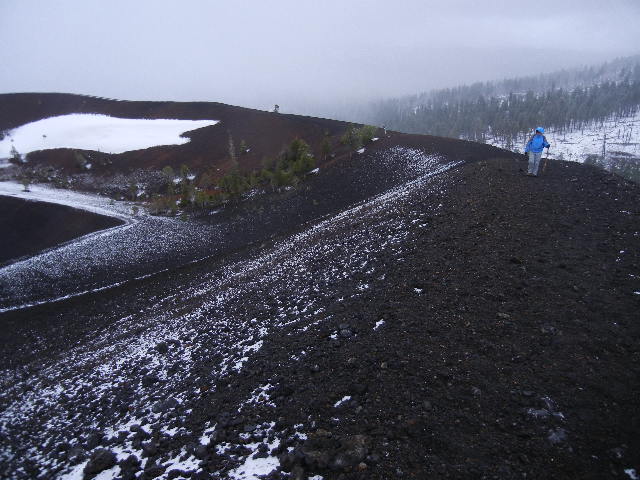
11 Jun: We woke to fresh snow on the ground (not very deep, since it fell mixed with rain). Before lunch we hiked to Cinder Cone, in the northeast part of the park. Lassen Volcanic NP has examples of all four main types of volcanos: shield volcano, cinder cone, plug dome volcano, and composite volcano. Numbered posts alerted us to descriptions in a trail brochure describing the volcanic history and features along the way. We then entered the wilderness area (about 75% of Lassen Volcanic NP is protected as a wilderness), where the trail ascended Cinder Cone, which erupted about 1650. Inside the main crater is a slightly smaller one. We hiked halfway around the outer rim and halfway around the inner rim. The fresh snow accentuated the contours of the two distinct craters. In the afternoon we hiked to Crag Lake on the Chaos Crags trail. It passed through some of the prettiest woods we hiked through in Lassen this week, but it was still in or beside an extensive burned area for some of the time, and the clouds closed in so we didn’t have any distant views.