Manitoba

14-16 August:  Another pretty full day of driving brought us the rest of the way through southern Saskatchewan (stopping in Regina to get Amy’s bike fixed) and into southwestern Manitoba, to Riding Mountain National Park.  This park contains three major ecological zones:  the Manitoba Escarpment, boreal forest, and aspen parkland.  In the visitor center we watched three excellent videos, about moose, the weasel family, and the park itself.  We drove to the eastern end of the park and hiked a trail up the escarpment to Bald Hill, a ridge with steep sides of loose shale, a sharp crest, and a fine view of the prairie in the distance below the escarpment.  The trail up to Bald Hill and back followed the brink of a steep slope beside a stream valley cut into the escarpment, with many good outlooks.  A short loop trail near the trailhead had interpretive signs naming and illustrating many of the local plants.  The day was cloudy and mostly we were hiking among deciduous trees and shrubs, which gave us a distinct feeling that we were indeed well on our way home to New England after many spending most of the summer in the West.
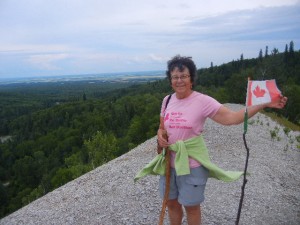
on the summit of Bald Hill near the top of the Manitoba Escarpment in Riding Mountain National Park
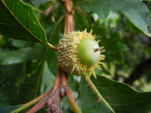
burr oak acorn
burr oak acorn
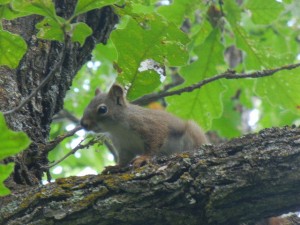
red squirrel scolding us as we hike by

From Riding Mountain NP, we drove east across Manitoba farmlands to Birds Hill Provincial Park, a little northeast of Winnipeg.  Our objective there was biking, and Birds Hill PP is great for that.  There are many kilometers of both paved and unpaved bike paths.  We wound through woods and fields, past a swimming beach and a lookout, and took the connector trail over a major highway on a bike bridge to the Duff Robin Parkway, which is a gravel bike path beside the floodway that was built to provide flood control for the Red River.  In 1950, the Red River flood caused Canada’s worst natural disaster.  The floodway that was built in the 1960s is a gated channel that allows floodwater to be diverted from the main channel of the Red River during extreme flood events.  At the time it was built, it was the second largest earthmoving project in the world, second only to the Panama Canal.  The system proved its worth in 1997, the year when a 100-year flood of the Red River devastated Grand Forks, S.D., and East Grand Forks, Minn., upstream of Winnipeg.  The floodway was later improved to withstand even a worse flood than that.  The connector trail that we rode crosses the floodway on a floating bridge that is open to biking except during flooding events when the floodway is in operation.
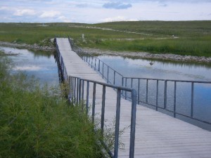
floating bridge for bikes over the floodway

Minnesota

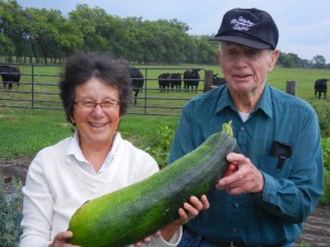
17-19 August:  We dipped south of the border to central Minnesota and paid a visit to Jack, Kyle’s grandfather (Corwyn’s great grandfather).  In his early 90s and a widower since 2004, Jack lives by himself on the farm where he was born and later he and his wife Alice raised three sons.  He introduced us to some of his friends and neighbors as they gathered for coffee in the tiny nearby village of Nimrod.  On the way home we stopped by a neighbor’s to pick some sweet corn for supper, and then Jack showed us around his garden, where we picked about a half dozen huge but still tender zucchini, and his back fields, which are rented out now that Jack has retired from dairy farming.  He told us a bit about the old days while Amy cooked stuffed zucchini to go with the corn, and we generally had a great visit with our genial and humble host.

Amy helping Jack pick zucchini from his garden

The next day we hadn’t scheduled any specific activities and didn’t have campground reservations, so we just headed out to see what we could find.  We passed through the busy tourist town of Walker and kept going north until we found a nice Forest Service campground on a lake with a bike trail around it.  We had a pleasant ride on the Mi-Gi-Zi bike trail around Pike Bay, followed by a swim in its clear water.  In the morning, after chatting a while with the couple camped across from us, we headed for Wisconsin.

Wisconsin

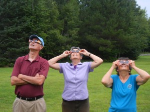
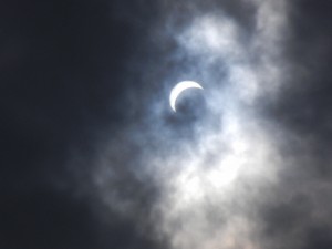
20-23 August:  For our first time camping in Wisconsin, we hiked, biked, and visited with two of Amy’s college friends in the northern part of the state, which is mainly forested with a lot of lakes.  We joined Ann & Gary, who live in St. Paul, Minn., at Copper Falls State Park.  The park’s namesake waterfalls are indeed coppery colored, but that’s due to tannin in the water—the name actually reflects early copper mining activity in the area.  The Bad River was able to erode a deep gorge, where the falls are, because the river follows cracks of a fault line.  The Tyler Forks, however, had to cut across the fault cracks, so it was not eroded nearly so deeply and it plunges over a 30-foot waterfall where it enters the Bad River gorge.  After viewing the falls we looked for the solar eclipse, which was about 80-90% in this area.  It was totally overcast, but we got some brief glimpses of the narrow crescent of the sun through thin spots in the clouds.

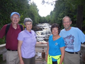
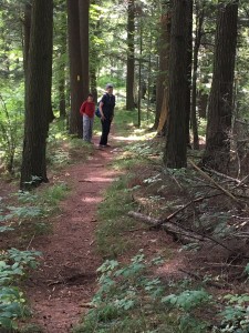
with Gary & Ann on the Copper Falls trail
looking for the eclipse
our ephemeral view of the eclipse

We next relocated to the Spearhead Point campground on Mondeaux Flowage, located along the Ice Age Trail.  This is a National Scenic Trail entirely within the state of Wisconsin that generally follows the terminal moraine of the last glaciation (the Wisconsin Glaciation).  The afternoon we arrived we hiked in one direction on the Ice Age Trail (picking some blackberries for our next breakfast), and the next day we hiked in the other direction.  For about seven miles, the trail follows the crest of an esker, a steep-sided ridge formed by a river depositing sand and gravel as it flows in a tunnel beneath the ice sheet.  This section of the Ice Age Trail was very pleasant indeed.

the Ice Age Trail along the top of an esker
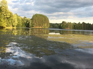
view from our campsite at Spearhead Point on Mondeaux Flowage

24-26 August:  After Ann & Gary had left, we moved northeast to explore some more biking and hiking trails in Wisconsin’s north woods.  This was once a thriving logging region, until most of the big white pines had been cut down.  The forests are a mix of spruce, fir, hemlock, pine (mostly red pine nowadays), and hardwoods such as birch and maple.  Most of Wisconsin’s farmland is farther south.  The terrain is relatively flat and there are many lakes, making this a popular vacation area for people in cities like Milwaukee and Green Bay.  We biked on the Bearskin State Trail, a bike trail on an old railroad grade.  It has several trestle bridges, over the winding course of the Bearskin Creek and also over some of the many swampy and boggy areas.  One time a locomotive and three cars derailed and tipped over beside the rail bed.  Two cranes were brought in to attempt to haul them out of the bog, but one of the cranes also fell in and they had to give up.  The crane, locomotive, and three cars have since sunken far below the surface (some bogs are as deep as 50 feet!).

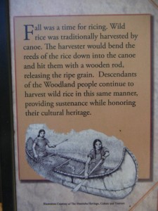
From our campsite on White Deer Lake we hiked around Luna and White Deer Lakes and also a bit of the Hidden Lakes Trail, to Butternut Lake.  This area has yielded artifacts such as pottery and stone and copper tools of the Woodland people, also known as the Archaic Tradition, whose living descendants include the Annishinabe (Ojibwe), Menominee, Potawatomi, and other tribes.

one small panel from an excellent sign on the Hidden Lakes Trail
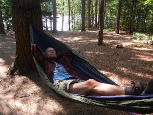
relaxing at White Deer Lake
view from the hammock

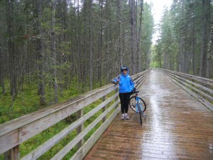
After over four months of dry weather for all of our hiking and biking, our luck finally ran out on a bike ride on the Three Eagle Trail.  After biking 12.7 miles from the north end in Eagle River to the south end in Three Lakes, it started to rain as we ate lunch before biking back and a steady drizzle continued the rest of the day.  It was a fine ride nonetheless.  This trail is partly a rail trail, partly a cross-country ski trail, and partly on quiet rural roads.  It is mostly out of earshot of cars and passes through very pretty woods, with views of lakes and bogs.

crossing the Black Spruce Boardwalk over a sphagnum bog in the rain
along the Three Eagle bike path

Upper Michigan

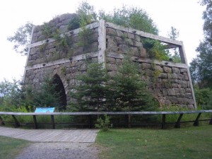
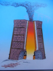
27-30 August:  On our way through Michigan’s Upper Peninsula, we camped for two nights near Lake Superior and two nights near Lake Michigan.  Pictured Rocks National Lakeshore stretches some 40 miles along the southern shore of Lake Superior.  Next to our campground was the historical site of Bay Furnace, the ruins of a blast furnace used to produce iron from 1870 until 1877, when it was destroyed by fire.  Bay Furnace is one of only two remaining examples of the 29 blast furnaces from that period in Upper Michigan.  Its location provided a sheltered anchorage for ships and access to abundant maple and beech trees for producing the charcoal that fueled the furnace.

iron blast furnace ruins at Bay Furnace
diagram of the blast furnace when it was operating

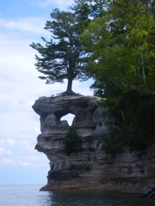
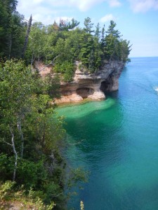
We spent a memorable day hiking around a loop that included about four miles of the Lakeshore Trail (also part of the North Country Trail) in one of the most dramatic parts of the Pictured Rocks shoreline, between Chapel Rock (an interesting rock pillar with arches through it and a white pine tree growing on top of it) and the Mosquito River.  That section of trail follows the edge of the cliffs, with frequent views of rocky headlands, coves, arches, and grottos formed from colorful sedimentary rocks.

trail to Chapel Falls, Chapel Rock, and Chapel Beach
Chapel Rock
Chapel Rock
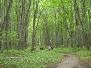
typical scenery along the Lakeshore Trail

Our next campsite was on Brevoort Lake, near the shore of Lake Michigan.  On the day we arrived there we went for a short hike on the nearby Ridge Trail, which followed the narrow crest of a steep-sided and very winding ridge next to the campground (another glacial esker, no doubt).  Amy swam in Lake Michigan after having swum in Lake Superior the day before, and began to wonder how many of the remaining three Great Lakes she might be able to swim in before we get home.  The water was definitely warmer in Lake Michigan than in Lake Superior (Paul decided to wait for sunnier and warmer weather for him to take the plunge).  Our principal motive for camping at Brevoort Lake, though, was to camp close to Mackinac Island.

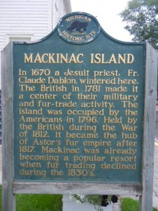
Mackinac Island has long been valued by Native Americans and Europeans alike for its strategic location in the Mackinac Straits where Lake Michigan flows into Lake Huron, close to Lake Superior, providing water routes to the south, east, and west.  For the Anishnaabeck people (Ottawa, Ojibway, and Potawatomi tribes) the island was used as a neutral location for trading, fishing, and ceremonial burials rather than for permanent settlements.  During the late 1600s through late 1700s, French trappers, traders, and missionaries used the island until it came into English possession following the French and Indian War.  Then the Americans took possession after winning the Revolutionary War.  England took the island back in a surprise raid during the early part of the War of 1812, but it reverted to America again in 1815 when the war ended.  The island became a popular resort destination soon afterward (well before the Civil War).  In the 1890s, cars were banned, and they are still banned today.  We took a ferry from St. Ignace on the mainland to Mackinac Island and took our bikes.  There are paved roads, but they are used solely by bicycles and horses, by both residents and tourists (including the eight-mile-long Michigan State Highway 185 that we rode around the entire perimeter of the island).  Besides the typical tourist amenities such as restaurants, hotels and cottages, museums, and gift shops, Mackinac has a number of hand-made fudge shops, a local specialty.

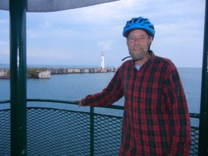
aboard the ferry to Mackinac Island
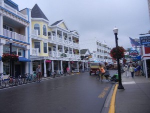
bike and horse traffic only on Mackinac Island streets
brief history of Mackinac Island