9 May: Our train ride from Ollantaytambo to Machu Picchu town (formerly named Agua Callientes) followed the Villcanota River (also known as the Urubamba River) downstream through a spectacular gorge. The cars were very comfortable, with skylights to enhance the views for the passengers. Peru Rail provided passionfruit juice, pastries with a sweet quinoa filling, and periodic announcements to “dear passengers” pointing out the sights we were passing, making the ride very enjoyable. After settling into our B&B we went to the botanical garden, situated on an Incan terrace near the trailhead up to the Machu Picchu ruins. The garden is very nicely landscaped and the plants are well-labeled. We were told that one of the plants there was the world’s biggest orchid species. After lunch back in town, we picked up some fruit and bread at the fresh market for the next day’s lunch up at the ruins.
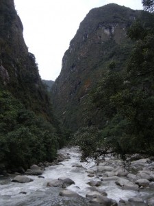
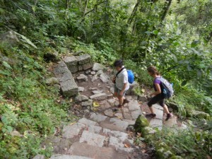
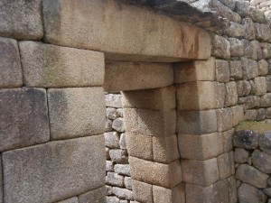
10 May: We hiked up to the Machu Picchu ruins from the river instead of taking one of the buses. The trail is very nicely constructed with stone stairs, and took us an hour and a quarter to climb. Our guide Gloria gave the three of us the two-hour tour of the ruins (she actually spent about three hours with us and was very friendly and informative). Machu Picchu was a complex of buildings high on a ridge top, providing the Sapa Inca with a beautiful country retreat from the capital of Cusco. It housed about 500 people and included temples and royal housing. When the Spanish invaded, the road to Machu Picchu was hidden from them, so the Incan buildings there escaped destruction by their hands. It wasn’t until 1911 that Yale professor Hiram Bingham found the ruins and brought Machu Picchu to the world’s attention (although locals knew of the ruins’ existence).
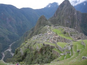
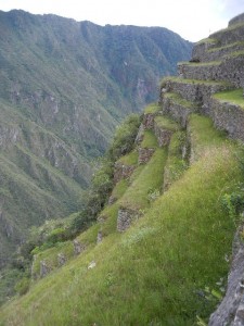
After lunch we hiked south up the ridge on the Inca Road to the Sun Gate, which has a commanding view of the Machu Picchu ruins and the prominent peak of Huayna Picchu mountain behind it. There we ran into Hal and Hilda from Colorado, whom we had met in Ollantaytambo, and together we hiked back down to the main ruins and then up and down the Inca Bridge trail, which curves around the west side of the ridge across an incredibly steep drop toward the river.
11 May: In the morning we relaxed in the warm water pools of Agua Callientes, the hot springs at the tributary that flows into the Villcanota River at Machu Picchu Town. Later we explored the extensive complex of souvenir markets between the river and the rail station, where locals sell a wide variety of exquisite crafts such as the beautiful traditional hand-woven products.