More Sinagua ruins

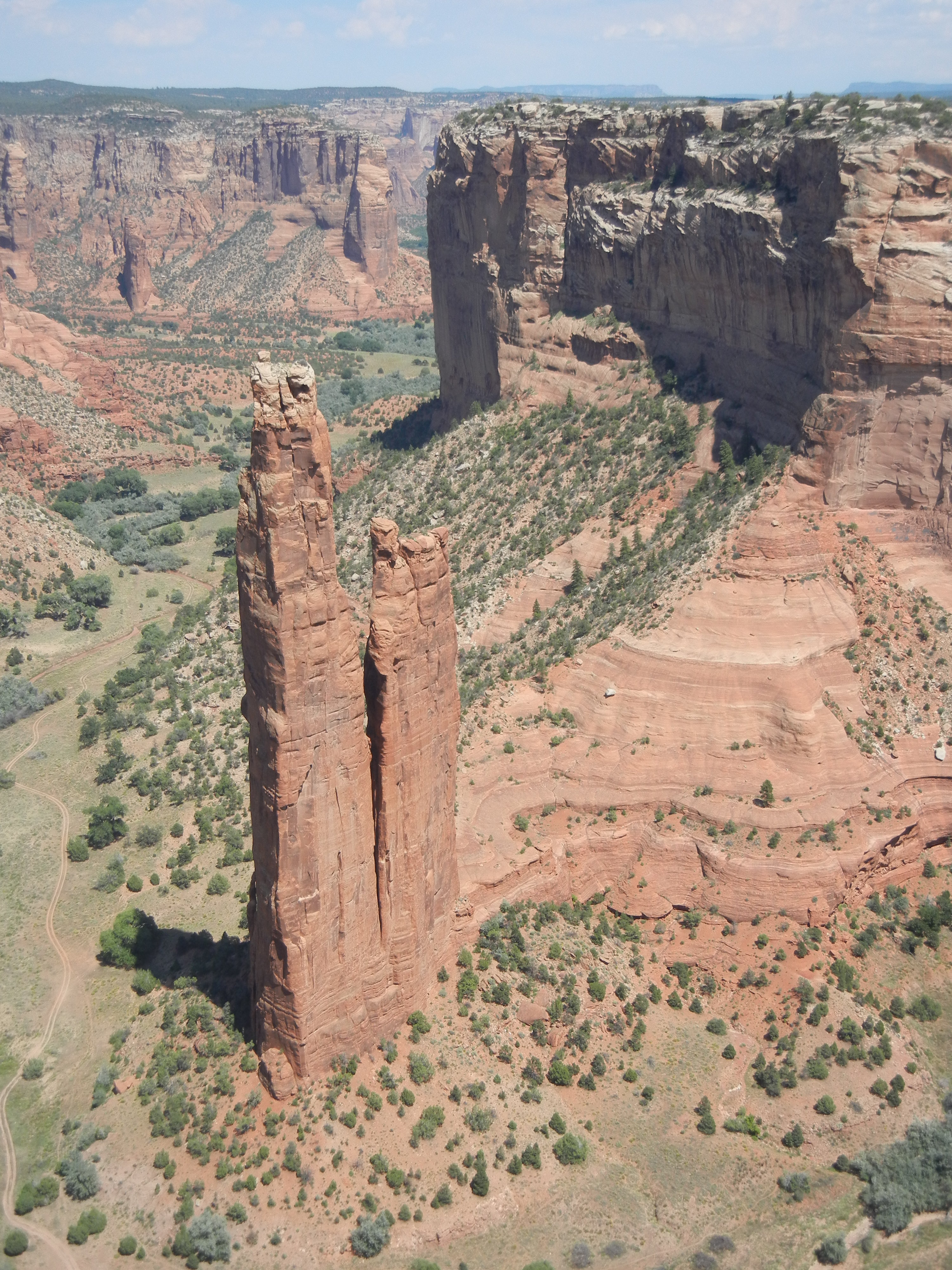
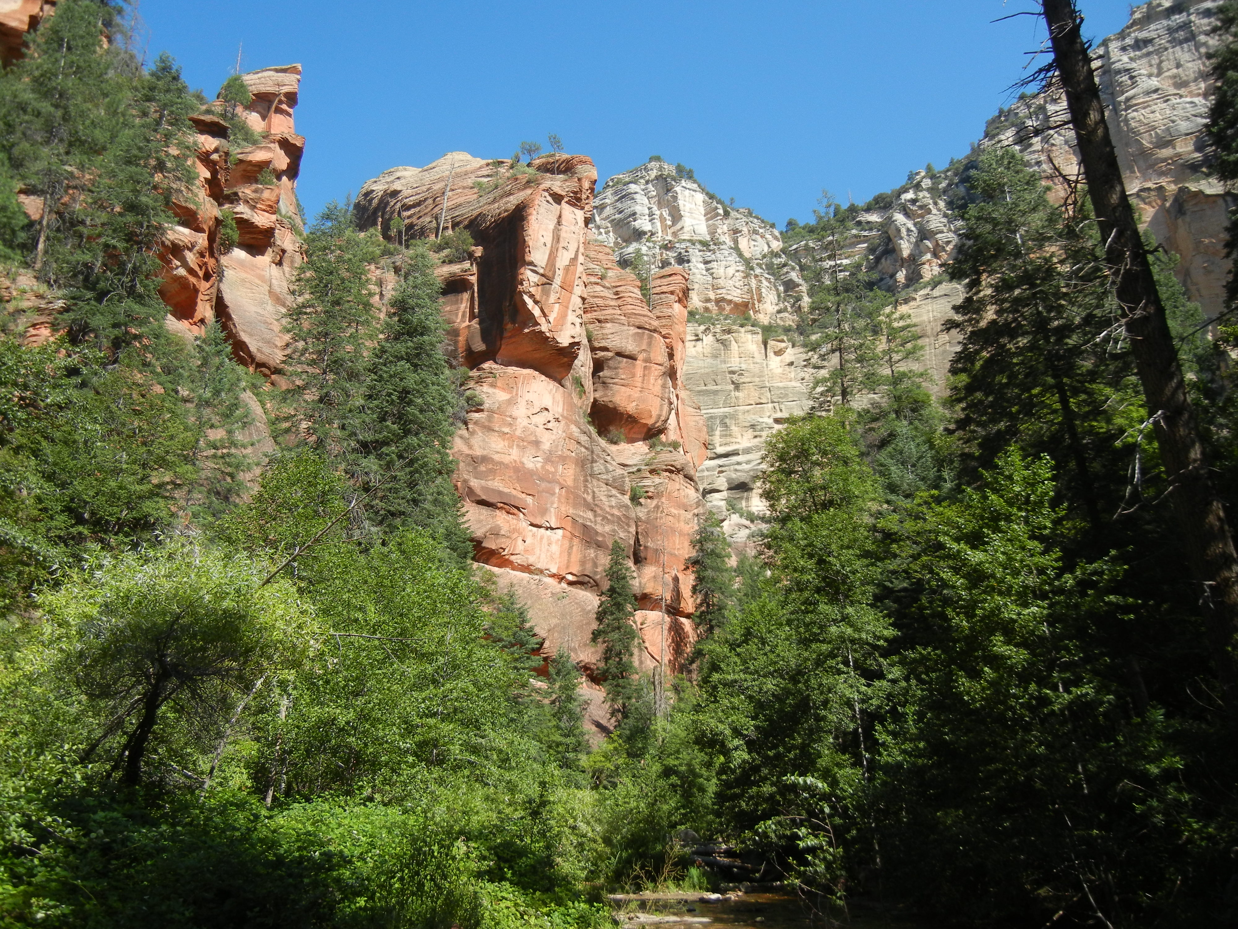
Day 65:  In the morning we hiked up the West Fork of Oak Creek, near our campground north of Sedona.  The trail was surprisingly well shaded, as it crossed and recrossed the creek many times under tall pine, oak, and Douglas fir trees at the bottom of the very high and narrow canyon.

blue flower in Oak Creek Canyon
west fork of Oak Creek Canyon

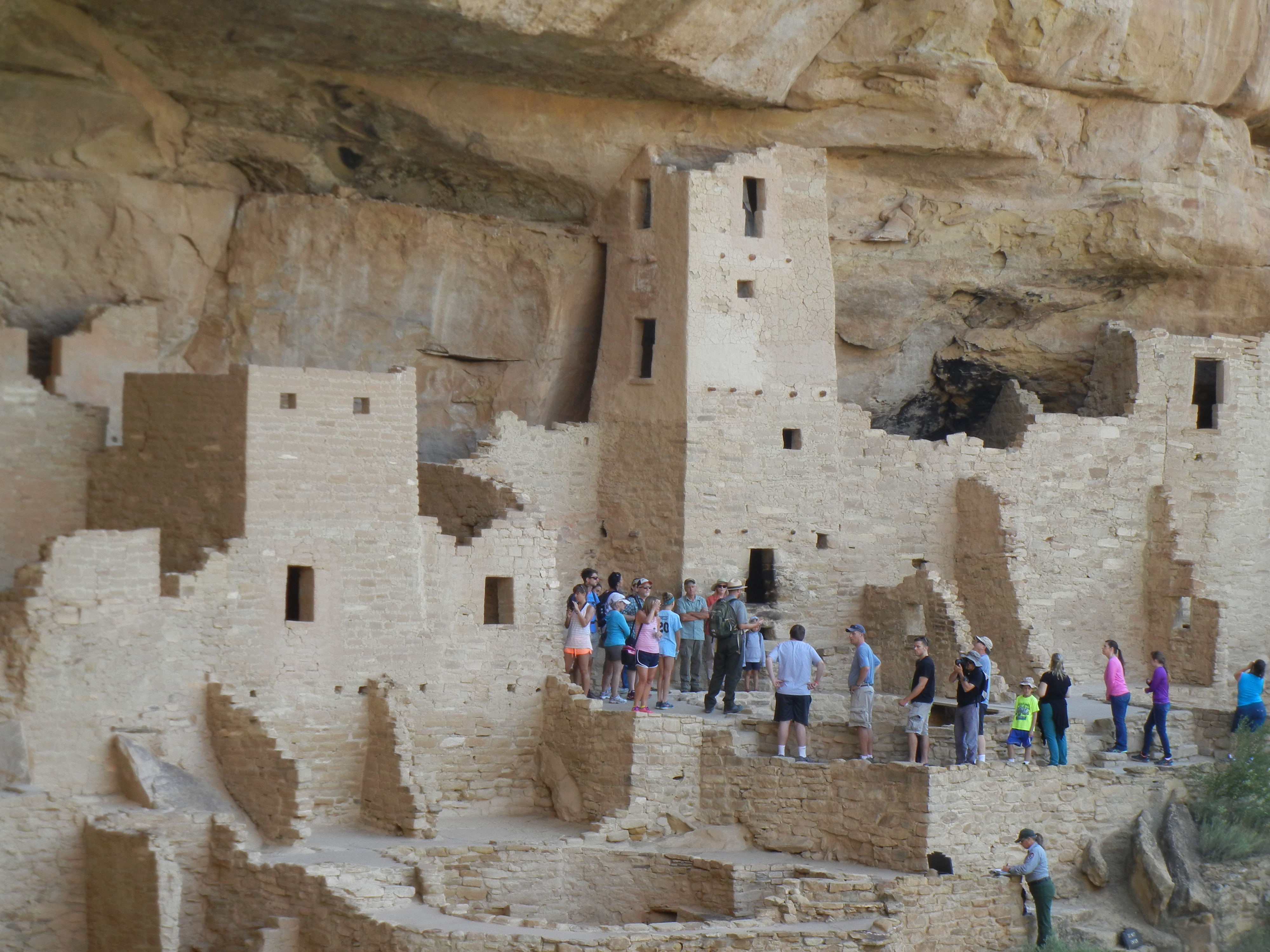
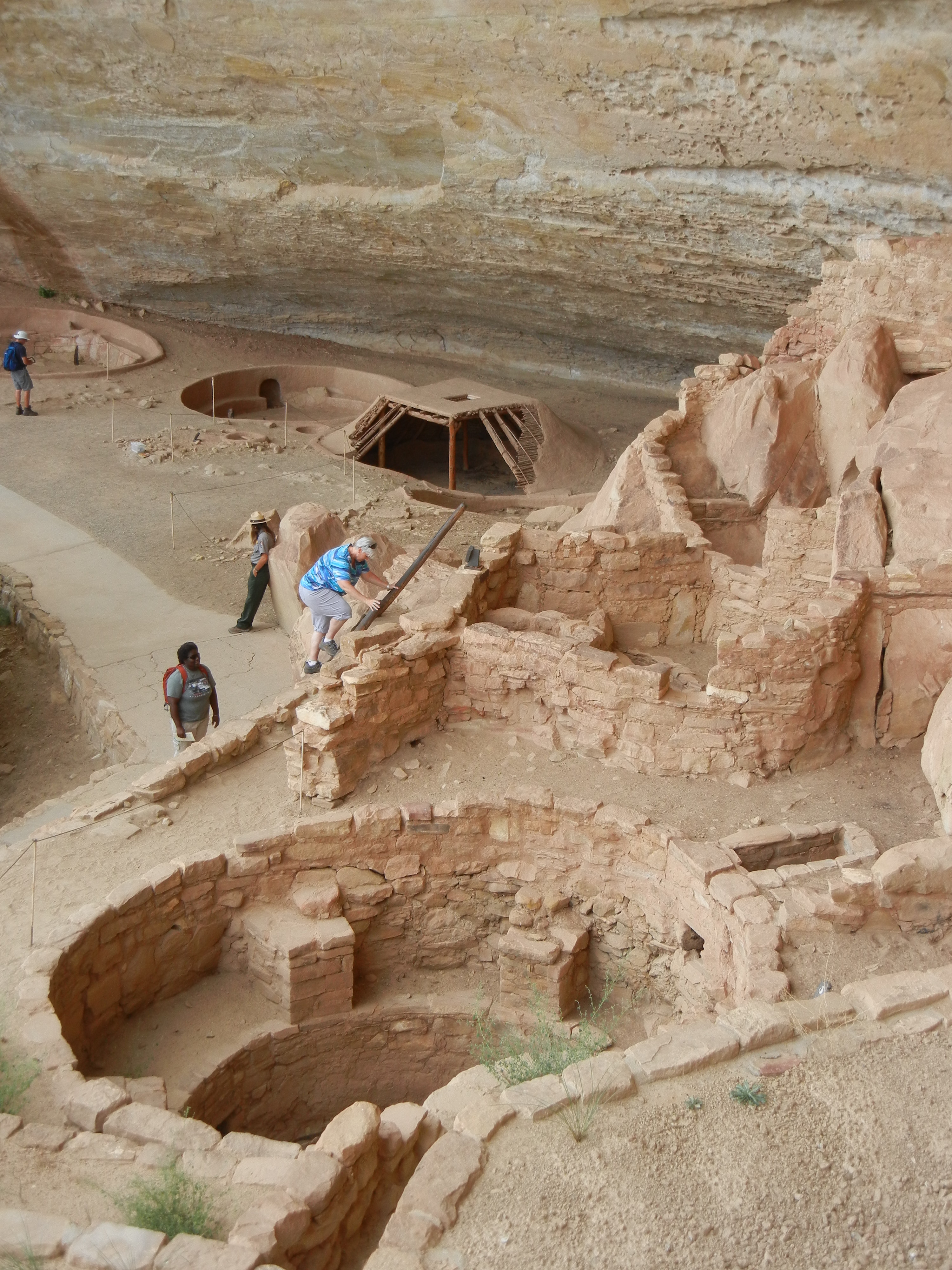
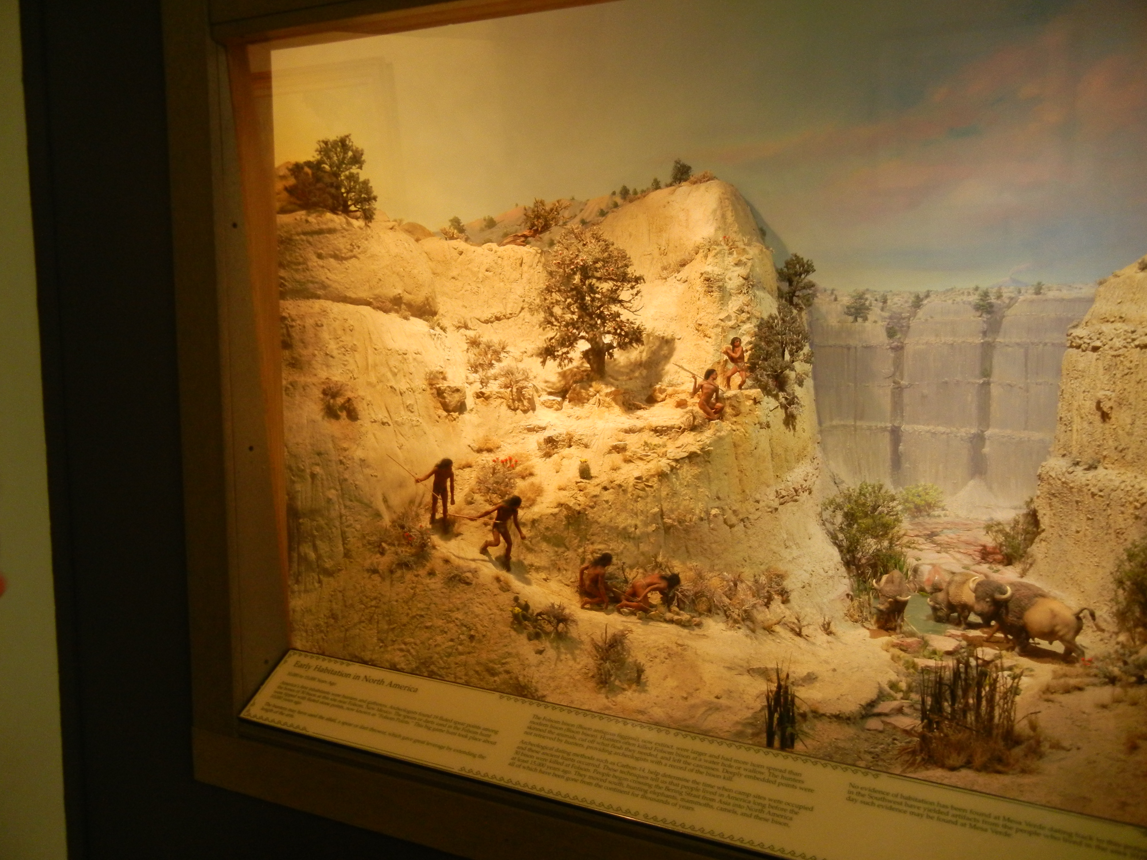
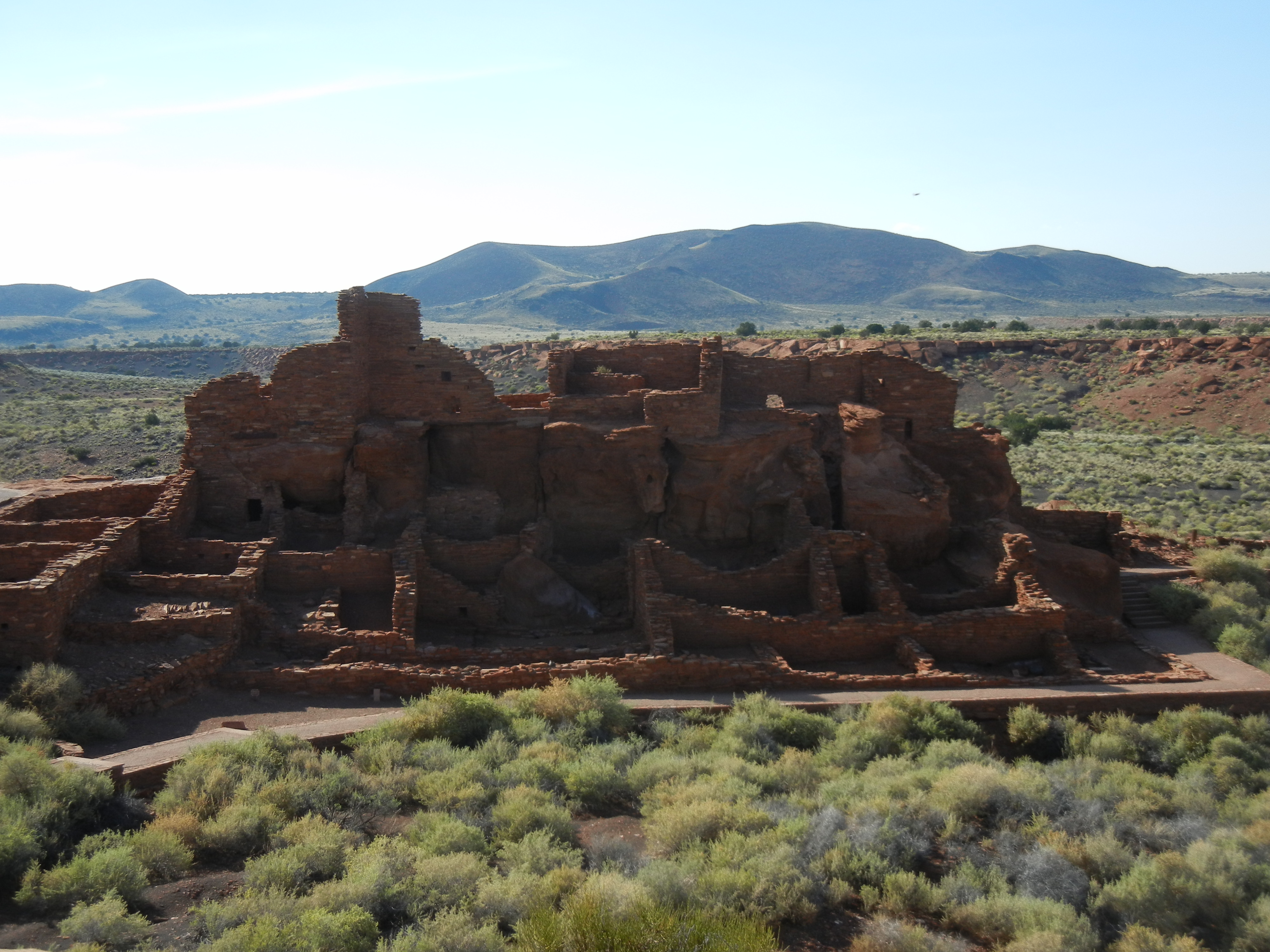
In the afternoon we explored two national monuments north of Flagstaff:  Sunset Crater NM and Wupatki NM.  Sunset Crater volcano erupted in the late 1000s and blanketed a wide area with cinders, lava, and ash, forcing the relocation of the Sinagua people living in the area.  The extinct volcano is now a large cinder cone, with some lava flows and smaller cinder cones nearby.  The Wupatki Ruin is the remains of a large pueblo-style village built in the early 1100s and occupied through the early 1200s.  This was a multi-story complex on a sandstone outcrop in an arid plain, complete with a ball court and a kiva (round ceremonial structure).

Wupatki ruin, north of Flagstaff

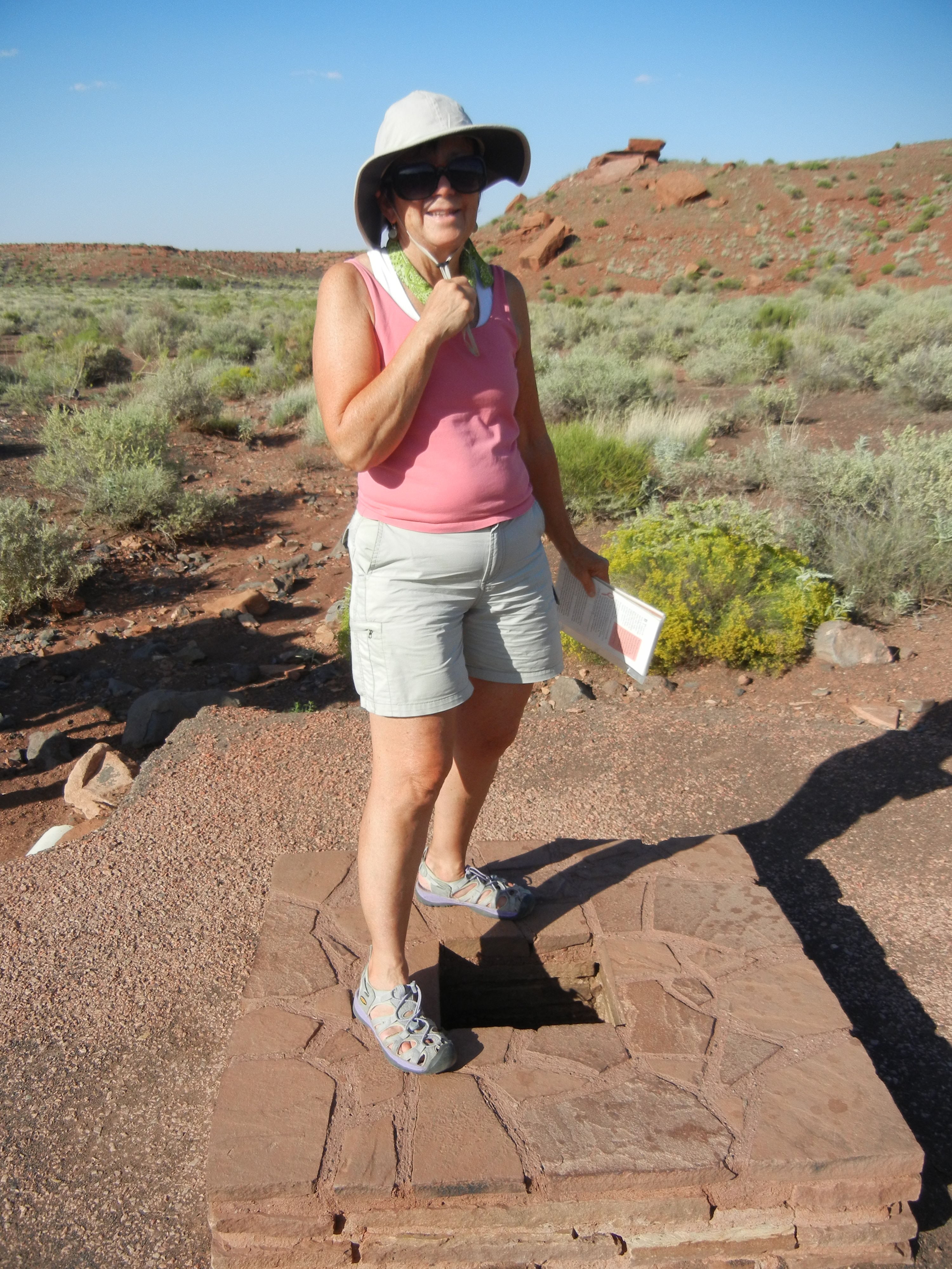
One unique feature there is the “blowhole,” a small opening to an underground limestone cavern below, through which the cave “breathes.”  When the outside air pressure is lower than the air pressure inside, the air flows out (it was a nice cool stream of air on the hot day we visited, feeling just like an air conditioner).

cooling off over the blowhole

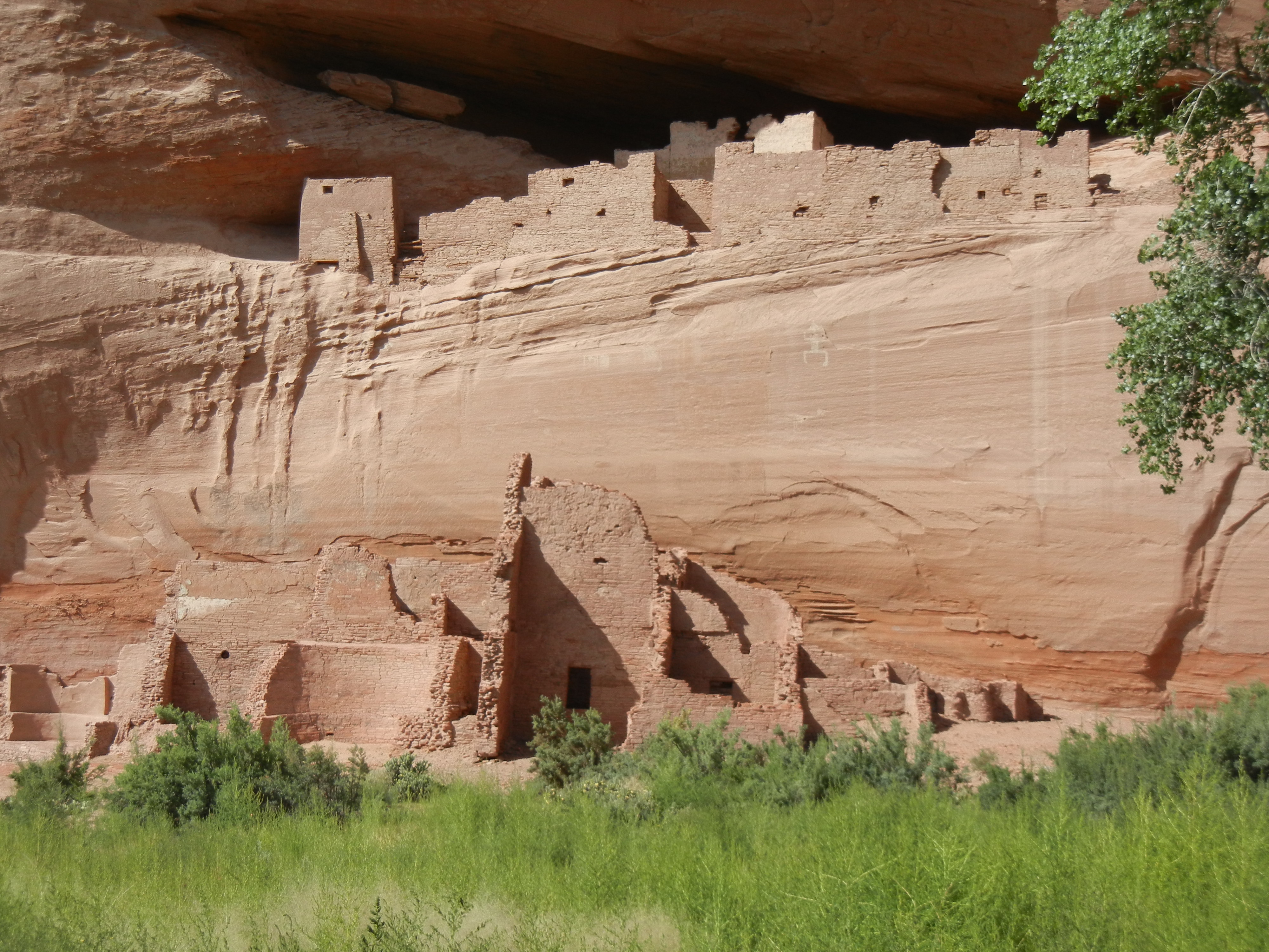
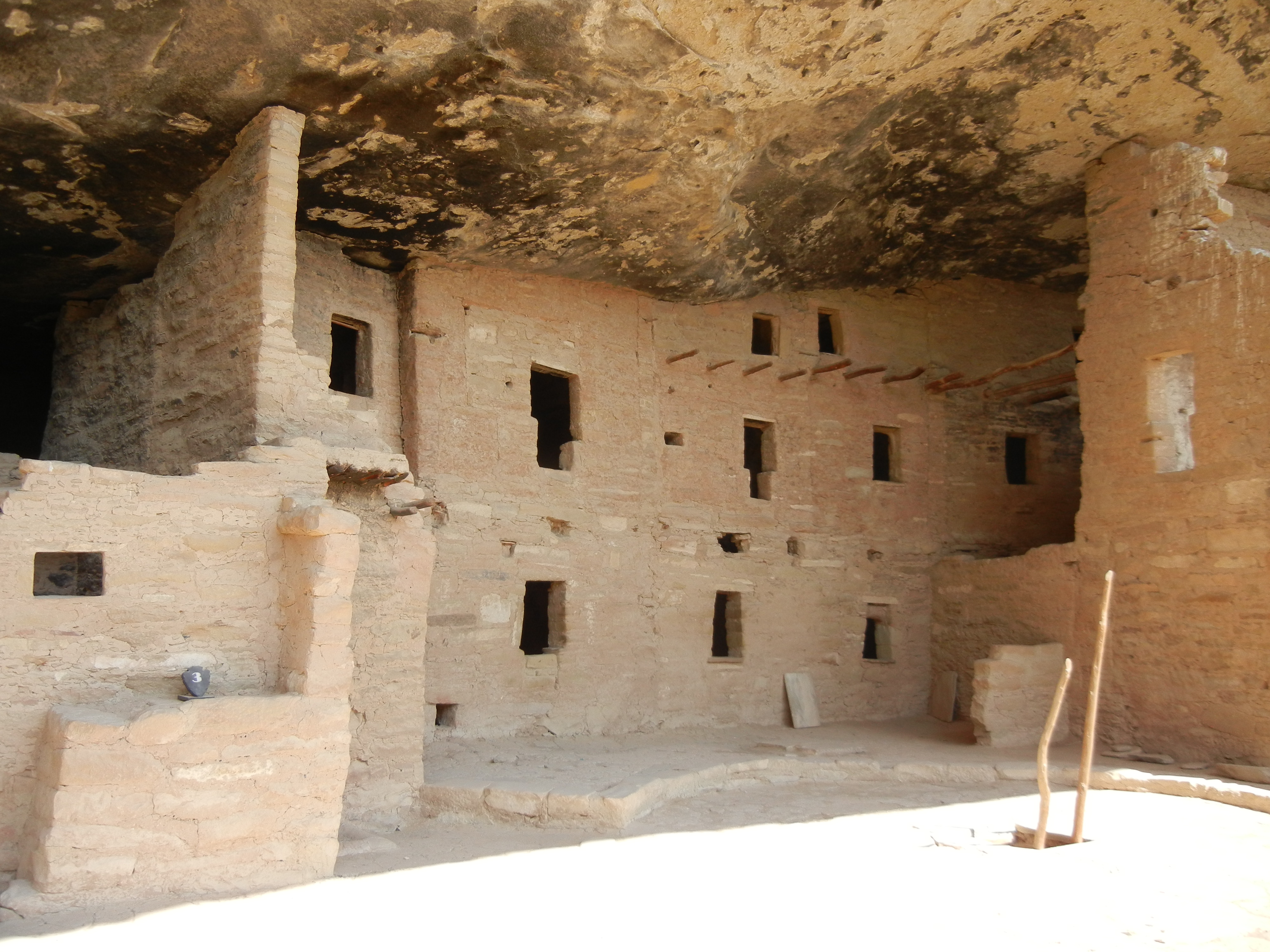
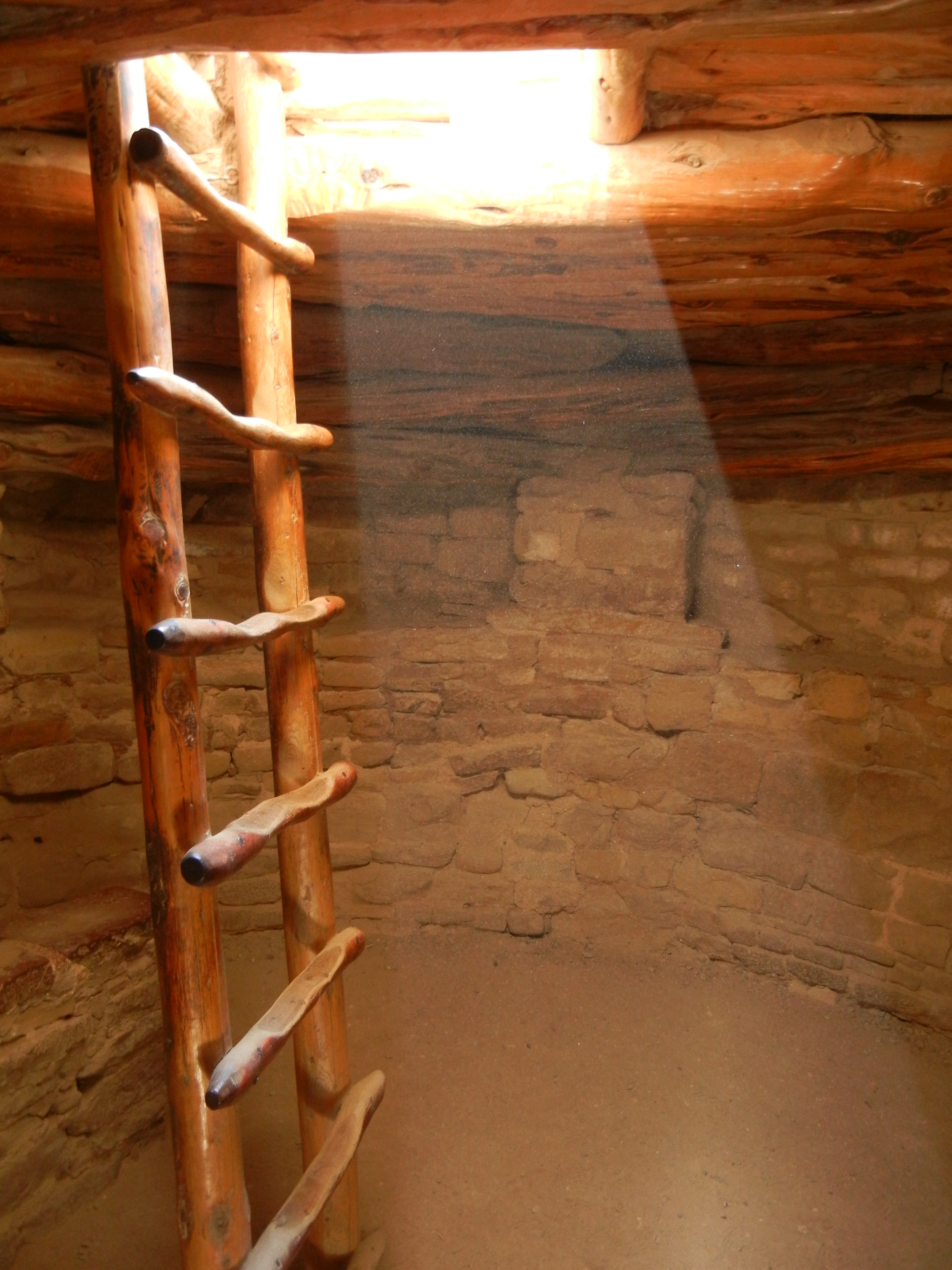
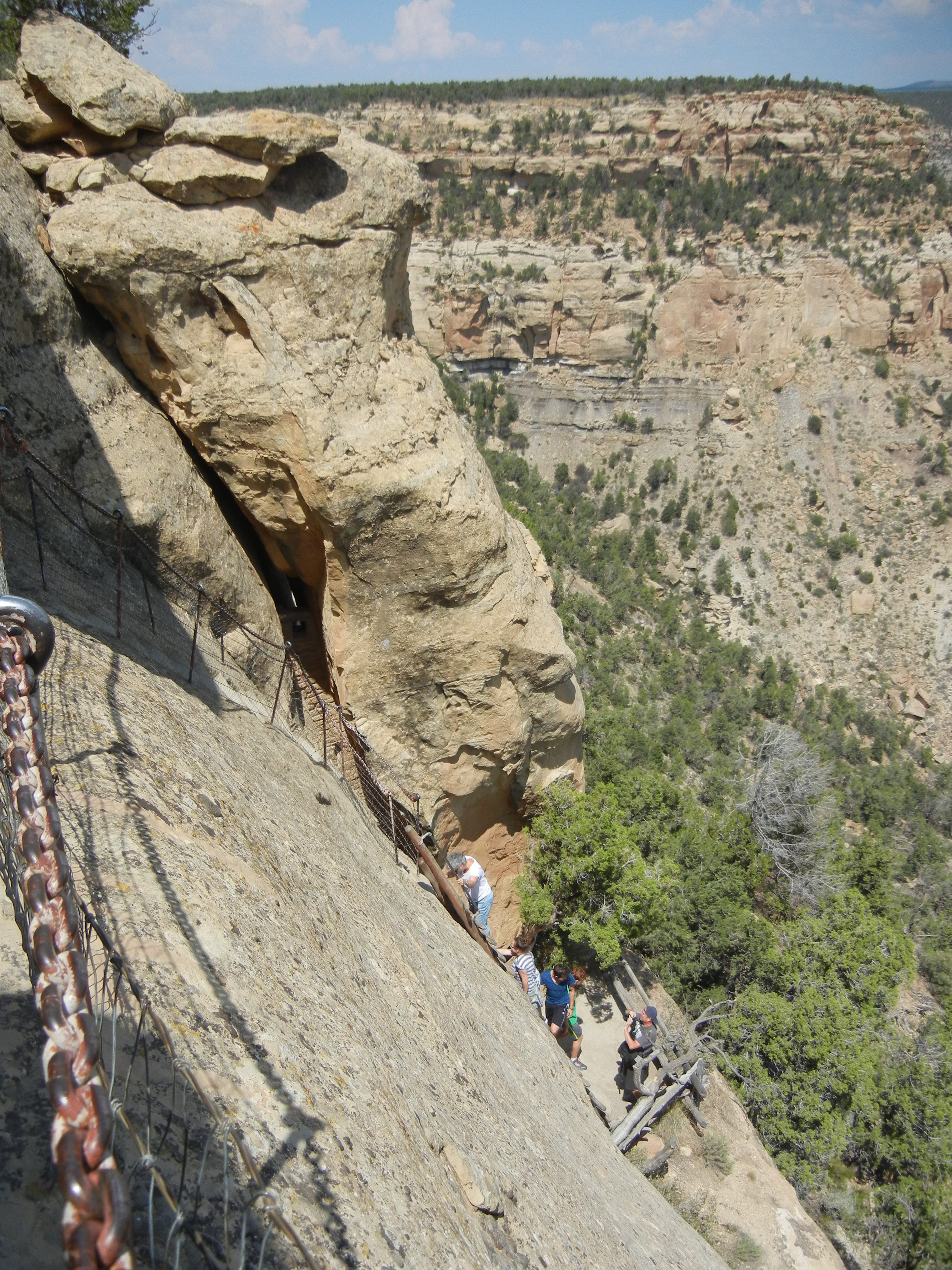
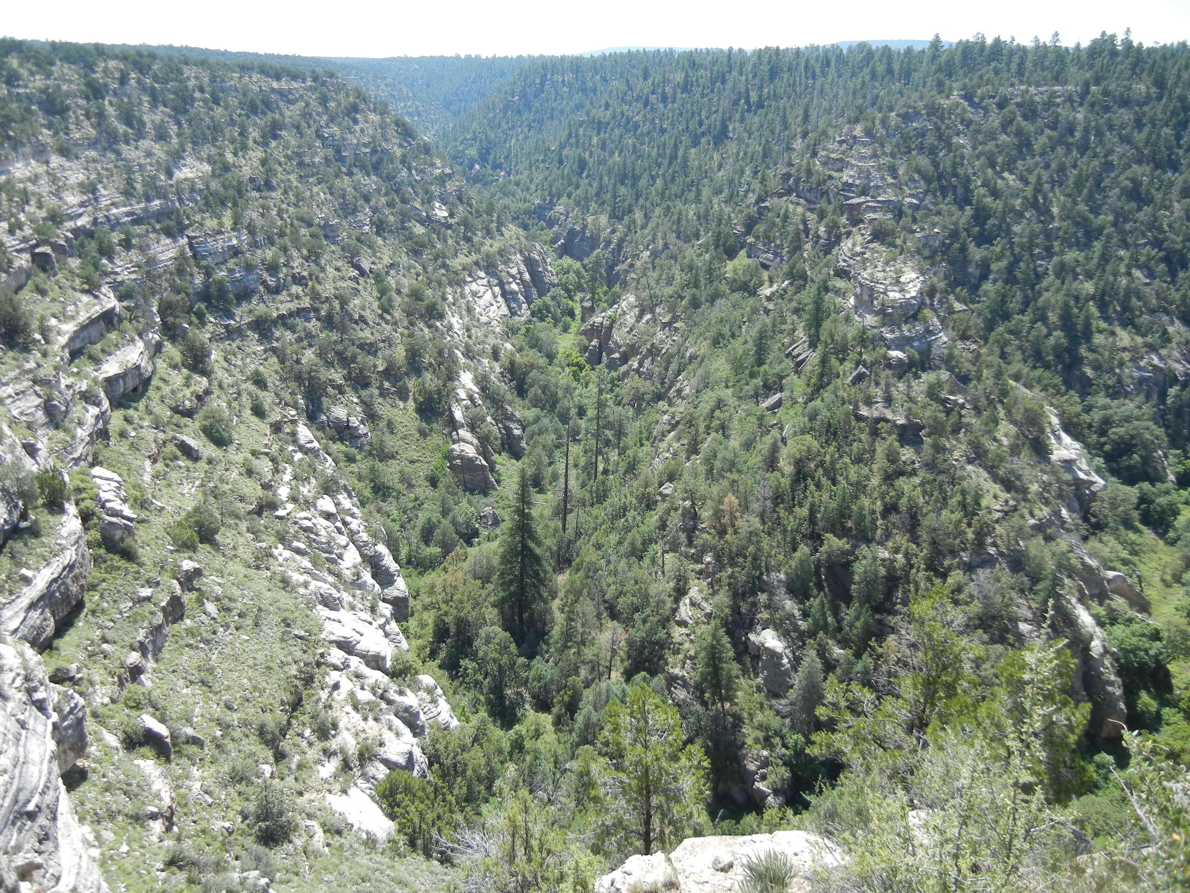
Day 66:  Walnut Canyon National Monument has another Sinagua ruin, but in a very different setting than the Honanki and Wupatki ruins we had previously visited.  The canyon is narrow and twisting, with walls that are steep, but not vertical.

Walnut Canyon
Walnut Canyon

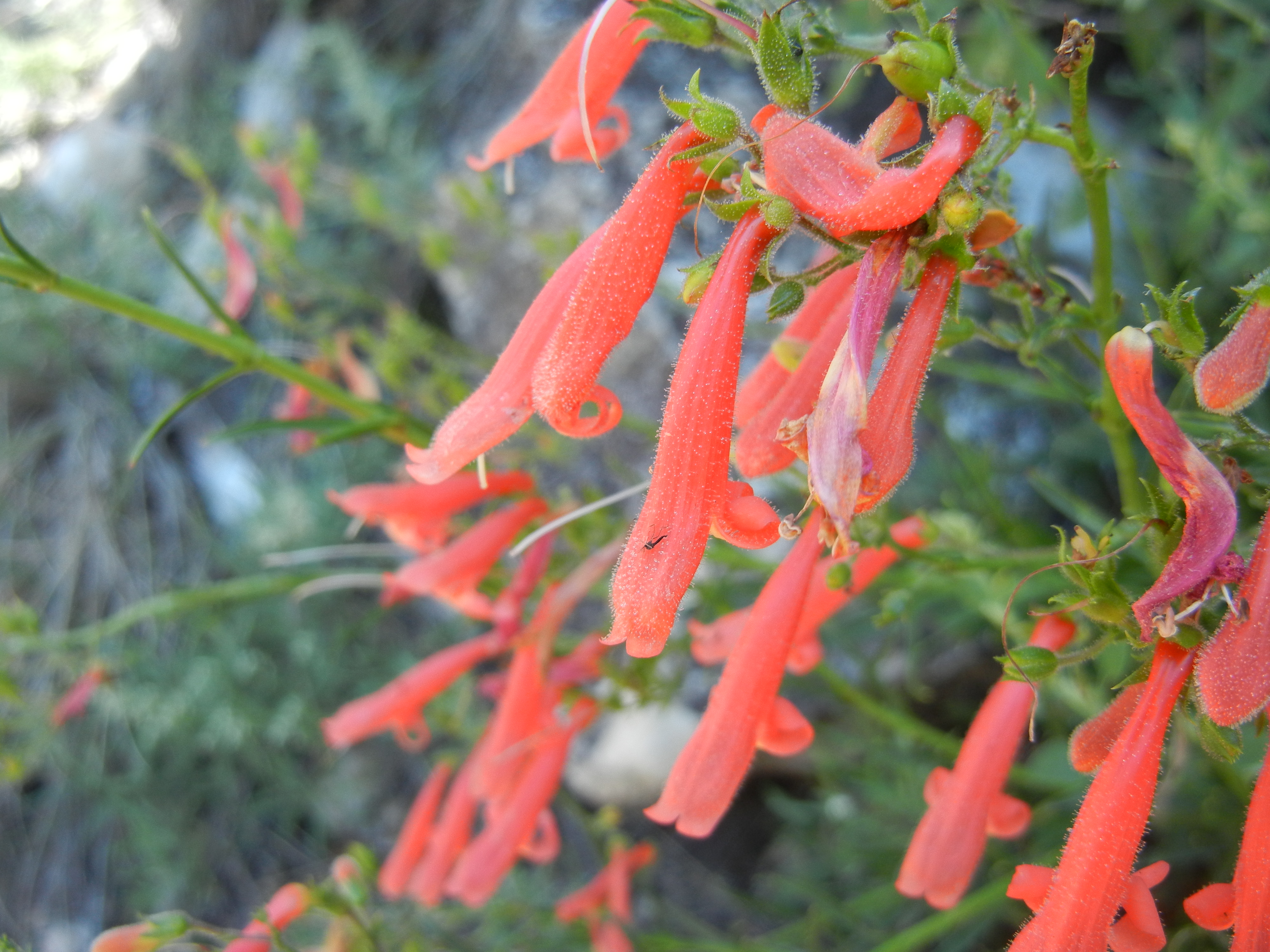
The adobe rooms built there are tucked inside natural alcoves formed when softer sandstone layers eroded faster than the harder overlying limestone layers.  Farming was done on the forested plateau above the canyon.  The canyon walls had varying sun exposure due to the meanders of the creek, so a very wide variety of native plants provided food, medicines, etc., to supplement the cultivated corn, squash, and beans.

one of many ruins nestled into the alcoves of Walnut Canyon
Island Trail in Walnut Canyon NM

100

Petrified Forest and Canyon de Chelly

Day 67:  Petrified Forest National Park in eastern Arizona not only has a lot of large petrified tree trunks, but it is special because much of them are “agatized” (the development of the mineral crystals in the petrified wood has advanced to a colorful gemlike state rather than just looking like the original wood).  The brittle petrified tree trunks have been broken into sections over the ages, the way a candy cane snaps if you try to bend it.  The scenery in the park included bands in the eroded sedimentary rock.  At the Painted Desert visitor center we chatted with a Navajo woman who told how she died wool from various local plants.

petrified tree
petrified tree
Navajo loom
Navajo loom
Navajo rug
Navajo rug

Day 68:  Canyon de Chelly is unusual among National Monuments because the canyon is not only valued for its scenery and ancient ruins, but it still provides homes and a living for an active Native American community.  Unlike the Sinagua sites, which were only occupied for one or two centuries, Canyon de Chelly has been the home of various native people nearly continuously for the last 2000 years (and it was visited sporadically or seasonally for several millennia before that).  We hiked down into the canyon in the morning guided by a ranger and an intern, who showed us ruins and pictographs and described the history of the people in the canyon.

Canyon de Chelly rock art

For lunch we sampled the local cuisine of roast mutton, white corn stew, and frybread at the weekly market in town.  In the afternoon we viewed the tall sandstone spire called Spider Rock in the upper canyon, joined a geology walk, then hiked down to the canyon floor to view the White House Ruin.

Spider Rock, Canyon de Chelly
White House Ruin in Canyon de Chelly

Mesa Verde

Day 69:  In the afternoon that we arrived in Mesa Verde National Park, we took a short hike on an interpretive trail that in 1914 was a precarious section of the main road into the park (later replaced with a newer road with a tunnel).  Signposts and a pamphlet identified several of the native plants.  The conspicuous yellow blossoms of the rabbitbrush shrubs were in full bloom.

rabbitbrush
rabbitbrush

The evening ranger program discussed competing theories of how humans immigrated into the New World (Bering land bridge and ice-free corridor, coastal migration by boat following the resources of the kelp beds, and trans-oceanic voyages from Polynesia).

Day 70:  The Ancestral Puebloans of Mesa Verde originally lived on the mesa tops where they farmed, but around 1200 they started building impressive cliff dwellings below the mesa rims in large natural alcoves.  We took a ranger-led walking tour through the Long House ruin and a self-guided tour of the Step House ruin, which are prime examples of the cliff dwellings.  These were multi-level complexes built of sandstone blocks and mortar, consisting of living quarters, storage rooms, and kivas.  The kivas were round subterranean rooms that appear to have been used for social as well as religious gatherings.

ladder entrance to a kiva below ground at Balcony House ruin
inside of a kiva with a reconstructed roof

On a self-guided tour of Badger House Community we saw examples of stages in the evolution from simple pit houses to clusters of sandstone and mortar houses and kivas that were built on top of the mesa before they built cliff dwellings below the rim.  The evening ranger program discussed trade connections of the Mesa Verdean people with three other New World cultures around the year 1200:  coastal Californian, Mayan, and Mississipian.

Day 71:  We spent this day in the Chapin Mesa section of the park, including ranger-led tours of the Cliff Palace and Balcony House ruins, perusing the archaeological museum, a self-guided tour of the Spruce House ruin, and a hike around the Petroglyph Point trail.  Each tour gave us more insight into how the Ancestral Puebloans thrived in this challenging climate and environment, so we were glad we went on all three tours.

touring Cliff Palace ruin
pit houses, pueblo rooms, and kiva at the Step House ruin

Today, tourists hike to the ruins on trails and ladders built by the Park Service and the CCC, but in 1200 the only access was by extremely steep and narrow trails that in many places were no more than small hand and toe holds chiseled into the steep sandstone cliffs.

ascent route from a cliff dwelling for today's tourists
ascent route from a cliff dwelling for today’s tourists
access to cliff dwelling alcoves for the original inhabitants

The museum has many artifacts recovered by archeological excavations and a set of exquisite dioramas painstakingly crafted by CCC artists depicting life at Mesa Verde from the nomadic hunter-gatherer times to the 1200s.

CCC diorama of early hunter gatherers of the Mesa Verde region